NASA’s Aqua satellite passed over the Northwestern Pacific Ocean and captured a good shot of the wide, ragged center of circulation in Tropical Storm Krosa.
NASA’s Aqua satellite passed over the Northwestern Pacific Ocean and captured a good shot of the wide, ragged center of circulation in Tropical Storm Krosa.
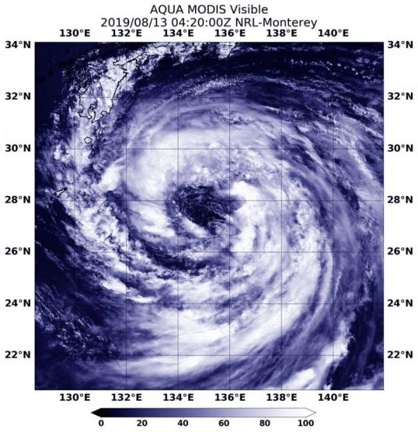
On Aug. 13 at 12:20 a.m. EDT (0420 UTC), the Moderate Resolution Imaging Spectroradiometer or MODIS instrument aboard NASA’s Aqua satellite provided a visible image of Krosa that showed a large center of circulation, surrounded by fragmented bands of thunderstorms.
At 5 a.m. EDT (0900 UTC), the center of Krosa was located near latitude 28.2 degrees north and longitude 133.9 degrees east. Krosa was about 397 nautical miles south-southeast of Iwakuni, Japan. Krosa was moving to the west-northwest and had maximum sustained winds near 45 knots (52 mph/83 kph).
Read more at NASA/Goddard Space Flight Center
Image: On Aug. 13, 2019, the MODIS instrument aboard NASA's Aqua satellite provided a visible image of Tropical Storm Krosa in the Northwestern Pacific Ocean. (Credit: NASA/NRL)


