It turns out that the steady dripping of water deep underground can reveal a surprising amount of information about the constantly changing cycles of heat and cold, precipitation and drought in the turbulent atmosphere above. As water seeps down through the ground it picks up minerals, most commonly calcium carbonate. When this mineral-rich water drips into caves, it leaves mineral deposits behind that form layers which grow during wet periods and form dusty skins when the water dries up. Today, scientists can date these layers with extreme precision based on the radioactive decay of uranium into its daughter product thorium. Variations in the thickness of the layers is determined by a combination of the amount of water seeping into the cave and the concentration of carbon dioxide in the cave’s atmosphere so, when conditions are right, they can provide a measure of how the amount of precipitation above the cave varies over time. By analyzing the ratios of heavy to light isotopes of oxygen present in the layers, the researchers can track changes in the temperature at which the water originally condensed into droplets in the atmosphere changes and whether the rainfall’s point of origin was local or if traveled a long way before falling to the ground.
It turns out that the steady dripping of water deep underground can reveal a surprising amount of information about the constantly changing cycles of heat and cold, precipitation and drought in the turbulent atmosphere above.
As water seeps down through the ground it picks up minerals, most commonly calcium carbonate. When this mineral-rich water drips into caves, it leaves mineral deposits behind that form layers which grow during wet periods and form dusty skins when the water dries up.
Today, scientists can date these layers with extreme precision based on the radioactive decay of uranium into its daughter product thorium. Variations in the thickness of the layers is determined by a combination of the amount of water seeping into the cave and the concentration of carbon dioxide in the cave’s atmosphere so, when conditions are right, they can provide a measure of how the amount of precipitation above the cave varies over time. By analyzing the ratios of heavy to light isotopes of oxygen present in the layers, the researchers can track changes in the temperature at which the water originally condensed into droplets in the atmosphere changes and whether the rainfall’s point of origin was local or if traveled a long way before falling to the ground.
In a study conducted by Vanderbilt University's assistant professor of earth and environmental sciences, Jessica Oster and her team, evidence was recorded of the last 50 years of growth of a stalagmite that formed in Mawmluh Cave in the northeastern Indian state of Meghalaya, an area credited as the rainiest place on Earth.
Studies of historical records in India suggest that reduced monsoon rainfall in central India has occurred when the sea surface temperatures in specific regions of the Pacific Ocean were warmer than normal. These naturally recurring sea surface temperature “anomalies” are known as the El Niño Modoki, which occurs in the central Pacific, and the Pacific Decadal Oscillation, which takes place in the northern Pacific.
When the researchers analyzed the Mawmluh stalagmite record, the results were consistent with the historical record. Specifically, they found that during El Niño Modoki events, when drought was occurring in central India, the mineral chemistry suggested more localized storm events occurred above the cave, while during the non-El Niño periods, the water that seeped into the cave had traveled much farther before it fell, which is the typical monsoon pattern.
“Now that we have shown that the Mawmluh cave record agrees with the instrumental record for the last 50 years, we hope to use it to investigate relationships between the Indian monsoon and El Niño during prehistoric times such as the Holocene,” said Oster.
The study was published May 19 in the journal Geophysical Research Letters by Oster’s group, working with colleagues from the Berkeley Geochronology Center, the Smithsonian Institution National Museum of Natural History and the University of Cambridge.
Read more at Vanderbilt University.
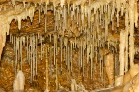
Cave image via Shutterstock.


