Drones, or unmanned aerial vehicles (UAVs), have been around since the early 1900s. Originally used for military operations, they became more widely used after about 2010 when electronic technology got smaller, cheaper and more efficient, prices on cameras and sensors dropped, and battery power improved. Where once scientists could only observe earth from above by using manned aircraft or satellites, today they are expanding, developing and refining their research thanks to drones.
Drones, or unmanned aerial vehicles (UAVs), have been around since the early 1900s. Originally used for military operations, they became more widely used after about 2010 when electronic technology got smaller, cheaper and more efficient, prices on cameras and sensors dropped, and battery power improved. Where once scientists could only observe earth from above by using manned aircraft or satellites, today they are expanding, developing and refining their research thanks to drones.
Drones can range from the size of airplanes to the size of bumblebees. They comprise part of unmanned aircraft systems that have a controller on the ground, and some form of wireless communication (usually radio signals) between the operator and the drone. Most small drones are powered by lithium-polymer batteries, while larger ones may use airplane engines. Many drones are made of carbon fiber making them light and easy to land without disturbing the environment. The Federal Aviation Administration requires that drones remain within the operator’s line of sight; larger drones that fly longer distances must obtain more involved licenses that allow them to fly outside of the line of sight.
Depending on their mission, drones are equipped with different payloads or equipment. Digital cameras can identify plants and animals, and help create 3-D maps. Thermal cameras detect heat from living creatures like animals or stressed plants, as well as from water. Hyperspectral imaging identifies features of plants and water through measuring reflected light and can interpret a wider range of wavelengths than the human eye can see. LiDAR, which measures how long it takes for an emitted pulse of light to reach a target and return to the sensor, can be used to calculate the distance to an object and its height, which is used for 3-D maps.
Read more at The Earth Institute - Columbia University
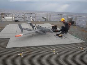
Image: Zappa’s engineer preparing the Broadband Longwave/Shortwave Radiation payload (Credit: Columbia University)


