The extent and depth of lakes in glaciated regions of North America are controlled by climate and the influence of differential isostatic rebound of the land's surface that began when Pleistocene ice melted from the continent. This relationship and the post-glacial history of Lake of the Woods -- one of the largest lake complexes in North America and the source of water for the city of Winnipeg -- is presented for the first time in a new study by five Canadian researchers.
The extent and depth of lakes in glaciated regions of North America are controlled by climate and the influence of differential isostatic rebound of the land's surface that began when Pleistocene ice melted from the continent. This relationship and the post-glacial history of Lake of the Woods -- one of the largest lake complexes in North America and the source of water for the city of Winnipeg -- is presented for the first time in a new study by five Canadian researchers.
Lake of the Woods covers ~4000 square kilometers and lies in the giant glacial Lake Agassiz basin of Ontario, Manitoba, and Minnesota, which was once the largest lake in the world. Ten sediment cores were collected by University of Manitoba geologists Jim Teller and Trevor Mellors, using a gravity coring system operated by a team from the Limnological Research Center at the University of Minnesota. These cores reveal dramatic hydrological changes in the lake during the past 12,000 years.
Sediments in the six cores studied consist mainly of laminated silty clay. Sedimentological, mineralogical, paleobiological, and stratigraphic analyses, constrained by 38 new AMS radiocarbon dates, reveal the post-glacial interplay of varying climate and differential isostatic rebound.
The most notable sediment characteristic in the cores is the presence of buried soils, which reflect periods when the level of the lake declined and sediments on its floor were exposed to weathering. Two periods of soil development are recorded, specifically (1) during an initial phase after the Lake of the Woods basin became isolated from Lake Agassiz ~10,500 to 10,000 years ago; and (2) during a 3,600-year-long negative hydrological budget and chronological hiatus related to mid-Holocene warming and drying, which is represented by <1 m of sediment.
Read more at Geological Society of America
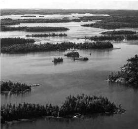
Image: Aerial view across Lake of the Woods and islands in northern part of basin. Photo source: Lake of the Woods Control Board (LWCB; 2002).


