NOAA's GOES East satellite provided an image of Post-Tropical Cyclone Selma as it dissipated near the border of El Salvador and Honduras.
NOAA's GOES East satellite provided an image of Post-Tropical Cyclone Selma as it dissipated near the border of El Salvador and Honduras.
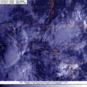
The National Hurricane Center final advisory on Selma was issued on Oct. 28 at 4 p.m. CDT (2100 UTC). At that time the National Hurricane Center said the center of Post-Tropical Cyclone Selma was located near 14.3 degrees north latitude and 88.8 degrees west longitude. At the time, maximum sustained winds had decreased to near 30 mph (45 kph) with higher gusts. The estimated minimum central pressure was 1007 millibars.
Read more at NASA/Goddard Space Flight Center
Image: NOAA's GOES East satellite provided a visible image of the remnant clouds over western Honduras on Oct. 29 at 8:45 a.m. EDT (1245 UTC). (Credit: NRL/NOAA)


