WASHINGTON (Reuters) - DigitalGlobe, provider of imagery for Google Inc's interactive mapping program Google Earth, said a new high-resolution satellite will boost the accuracy of its satellite images and flesh out its archive. The new spacecraft, dubbed WorldView I, is to be launched on Tuesday. Together with the company's existing Quickbird satellite, it will offer half-meter resolution and will be able to collect over 600,000 square kilometers of imagery each day, up from the current collection of that amount each week, Chief Executive Jill Smith told Reuters in a telephone interview.
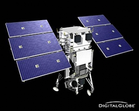
WASHINGTON (Reuters) - DigitalGlobe, provider of imagery for Google Inc's interactive mapping program Google Earth, said a new high-resolution satellite will boost the accuracy of its satellite images and flesh out its archive.
The new spacecraft, dubbed WorldView I, is to be launched on Tuesday.
Together with the company's existing Quickbird satellite, it will offer half-meter resolution and will be able to collect over 600,000 square kilometers of imagery each day, up from the current collection of that amount each week, Chief Executive Jill Smith told Reuters in a telephone interview.
!ADVERTISEMENT!
She said Tuesday's launch -- to be broadcast live on the Internet at http://www.boeing.com/defense-space/space/bls/missions/worldview-1/ -- and the planned launch of a second Worldview II satellite in late 2008, were critical milestones for the company.
Privately held DigitalGlobe is still working toward an initial public offering in the next few years, Smith said. She declined to say whether that could come before the launch of the second WorldView satellite.
"The business is as strong as we had hoped," Smith said, adding, "The key is to continue to hit the milestones that we've set."
Once its third satellite is launched, DigitalGlobe said it will be collecting more than 1 million square kilometers per day of high-resolution imagery.
Smith said WorldView I should allow far faster collection of imagery and add more quickly to the company's archive, which is already the world's largest commercial archive of satellite images. The library contains more than 300 million square kilometers of satellite and aerial imagery.
MORE ACCURATE DATA
The new satellite will also provide far more accurate data, including the ability to pinpoint objects on the Earth at three to 7.5 meters, or 10 to 25 feet. Using known reference points on the ground, the accuracy would rise to about two meters, Smith said.
DigitalGlobe built the satellite in part with $500 million in funding from the Pentagon's National Geospatial-Intelligence Agency (NGA), but it can sell the images commercially as long as their resolution is no sharper than a half-meter.
Its publicly traded rival, GeoEye Inc, is due to launch its next-generation high-resolution satellite this year but has pushed the launch back until the spring of 2008, said spokesman Mark Brender.
DigitalGlobe continues to expand sales and partnerships rapidly, Smith said, noting that one of her goals is to expand the ability to deliver images online to an increasingly broad customer base.
Smith said the U.S. military increasingly views commercial satellite imagery as a "core part of the military infrastructure," although there will always be a critical role for purely military satellite systems.
Smith said DigitalGlobe invested heavily in testing to make sure that Tuesday's launch of WorldView is successful.
A failure would be a setback, she said, but would not have a material effect on the company, given that its current satellite, QuickBird, was expected to last for at least two to three years and it already has begun work on WorldView II.
"The fortunate fact, which distinguishes us from other players, is that we have a very healthy high-growth core business," and WorldView II is already under way, Smith said.
© Reuters2007All rights reserved


