
Covering about 70 percent of our planet's surface, the ocean acts as a global thermostat, storing energy from the sun, keeping Earth's temperature changes moderate and keeping climate change gradual. In fact, the ocean can store as much heat in its top 10 feet as the entire atmosphere does. What happens in the atmosphere has usually the most effect on where humanity lives but the ocean really controls the world's climate more.
Covering about 70 percent of our planet's surface, the ocean acts as a global thermostat, storing energy from the sun, keeping Earth's temperature changes moderate and keeping climate change gradual. In fact, the ocean can store as much heat in its top 10 feet as the entire atmosphere does. What happens in the atmosphere has usually the most effect on where humanity lives but the ocean really controls the world's climate more.
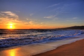
!ADVERTISEMENT!Heat and moisture from the ocean are constantly exchanged with Earth's atmosphere in a process that drives our weather and climate. Scientists at NASA and elsewhere use a variety of direct and satellite based measurements to study the interactions between the ocean and atmosphere.
There are four factors that control temperature at any given location on earth: 1) latitude, 2) elevation, 3) ratio of land and water, and 4) ocean currents.
The heat equator, the region of highest mean annual temperature, is about 10 degrees north latitude. Thus, the Northern Hemisphere is warmer than the Southern Hemisphere. The Northern Hemisphere has a greater fraction of land at tropical latitudes, and ocean currents transport more warm water to the Northern Hemisphere. There is an exchange of heat and moisture between the ocean surface and the atmosphere.
Because of the difference in heat capacity between water and air, even a small change in surface ocean temperatures could modify atmospheric circulation, which could have far reaching effects on global weather patterns.
"These interactions result in large scale global climate effects, the largest of which is the El Nino-Southern Oscillation," explained Josh Willis, a Jet Propulsion Laboratory oceanographer and climate scientist. This climate pattern appears in the tropical Pacific Ocean roughly every four to 12 years and has a powerful impact on the ocean and the atmosphere. It can disrupt global weather and influence hurricanes, droughts and floods. It can also raise or lower global temperatures by up to 0.4 degrees Fahrenheit.
El Nino is characterized by unusually warm ocean temperatures in the Equatorial Pacific, as opposed to La Nina, which characterized by unusually cold ocean temperatures in the Equatorial Pacific. El Nino is an oscillation of the ocean atmosphere system in the tropical Pacific having important consequences for weather around the globe.
Among these consequences are increased rainfall across the southern tier of the US and in Peru, which has caused destructive flooding, and drought in the West Pacific, sometimes associated with devastating brush fires in Australia. Observations of conditions in the tropical Pacific are considered essential for the prediction of short term climate variations.
Large El Ninos, such as the most powerful El Nino of the past century in 1997 to 1998, tend to force Earth's average temperatures temporarily higher for up to a year or more. Large areas of the Pacific can be one to two degrees Celsius (around two to four degrees Fahrenheit) above normal, and the average temperature of the ocean surface tends to increase. The current El Nino began last October and is expected to continue into mid-2010. Scientists at NASA's Goddard Institute of Space Studies in New York estimate that if this pattern persists, 2010 may well go down as the warmest year on record.
El Nino's cold counterpart is La Nina. During La Nina, trade winds are stronger than normal, and cold water that usually sits along the coast of South America gets pushed to the mid-equatorial region of the Pacific. La Ninas are typically associated with less moisture in the air and less rain along the coasts of the Americas, and they tend to cause average global surface temperatures to drop. The last La Nina from 2007 to 2009 helped make 2008 the coolest year of the last decade.
There are other broader range patterns that have effects associated with the ocean. During non-El Nino conditions, the Walker circulation is seen at the surface as easterly trade winds which move water and air warmed by the sun towards the west. This also creates ocean upwelling off the coasts of Peru and Ecuador and brings nutrient rich cold water to the surface, increasing fishing stocks.
Both El Nino and La Nina play out on a larger stage that operates on decade long timescales. The Pacific Decadal Oscillation, or PDO for short, describes a long-term pattern of change in the Pacific Ocean that alternates between cool and warm periods about every five to 20 years.
The PDO can intensify the impacts of La Nina or diminish the impacts of El Nino. In its "cool, negative phase," warm water, which causes higher-than-normal sea surface heights (because warmer water expands and takes up more space), forms a horseshoe pattern that connects the north, west and south Pacific with cool water in the middle. In its "warm, positive phase," these warm and cool regions are reversed, and warm water forms in the middle of the horseshoe.
During the 1950s and 1960s, the PDO was strongly negative, or cool, and global temperatures seemed to level off. During most of the 1980s, 1990s and 2000s, the Pacific was locked in a strong positive, or warm, PDO phase and there were many El Ninos. Currently this is the early stage of a cool PDO phase that began around 2006.
For further information: http://www.jpl.nasa.gov/news/news.cfm?release=2010-060&rn=news.xml&rst=2495


