
New wind resource maps and wind potential tables for the lower 48 states were recently released by AWS Truewind in collaboration with the National Renewable Energy Laboratory (NREL). This new data marks the first state-by-state comprehensive update of wind energy potential since 1993. Accurate information about the wind resources available in each state will help keep the momentum in wind energy development going strong in 2010. If state and federal policies need valid evidence of wind potential to promote this clean energy source, then that data has arrived.
New wind resource maps and wind potential tables for the lower 48 states were recently released by AWS Truewind in collaboration with the National Renewable Energy Laboratory (NREL). This new data marks the first state-by-state comprehensive update of wind energy potential since 1993. Accurate information about the wind resources available in each state will help keep the momentum in wind energy development going strong in 2010. If state and federal policies need valid evidence of wind potential to promote this clean energy source, then that data has arrived.
!ADVERTISEMENT!
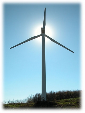
We know that wind power is an inexhaustible source of energy that can play a large part in creating a sustainable future, but there are real-life factors that keep this resource grounded. Transmission and storage of the generated energy requires a modern power infrastructure that is expensive and controversial. Additionally, developers need a stable policy environment if they are expected to commit to long-term projects with tremendous up-front costs. But no wind-power skeptic can spend a few days in Texas and claim that wind is not a viable solution to our future energy woes — just check the new map.
At the 80-meter height, the estimated wind energy potential of available development sites yield 10,459GW (gigawatts) of installed capacity. The new estimates are available on the AWS Truewind website and the NREL website. The current installed wind capacity in the US is 35GW and 158GW world-wide. In 2009, the U.S. wind industry added about 10GW of new capacity, enough to power the equivalent of 2.4 million homes.
The maps and estimates were created with a weather modeling system and then refined with measurements from wind monitoring stations. The NREL has already conducted a preliminary review and validation of the AWS Truewind's 80 meter map estimates for 19 selected states across the US using wind monitoring station measurements at heights of about 50 meters and above from more than 300 locations. The estimates show the windy land area with a gross capacity factor (without losses) of 30% and greater. Capacity factor compares a turbine’s actual production over a given period of time with the amount of power the plant would have produced if it had run at full capacity, or at full sail, for the same amount of time.
An important consideration for wind energy is its dependency on variable but predictable weather patterns. For example, average US wind speeds in 2009 were up to 10% lower than their long-term averages in key locations, and they were slightly higher in others. This significant difference was caused by the El Niño climate fluctuation. 3Tier, a renewable energy mapping and data solutions company, provides a visualization of these fluctuations. But wind is not the only renewable that is affected by weather patterns: Solar and hydroelectric power resources are in the same boat.
Large-scale wind power projects need more than just good data on placement locations. They need a way to tie into the grid and sell that clean wind energy to big urban markets. Currently, this is a significant factor affecting the viability of many wind power projects. A speedy transition to a clean energy economy needs a Renewable Energy Transmission Highway, and this is one of the legislative priorities of the American Wind Energy Association. While an improved transmission grid might conjure up images of even more ghastly metal towers criss-crossing the US, there is a better alternative. Underground super-cooled transmission lines can efficiently transmit electricity when they are refrigerated, and the cost per mile is comparable to the standard above-ground transmission cables. However, this technology requires substations about every mile in order to keep the coolant cold, so it is best for shorter distances. Another technology instead uses direct current (DC) for a high-temperature underground superconducting transmission system. The Electric Power Research Institute recently released a report that indicates the high-temperature superconducting lines are a practical and efficient way to improve electric grids.
The large-scale concept of renewable energy calls for an interconnected, national renewable energy infrastructure so that wind, solar, and hydro developers and utilities can plug in. Others see long-distance transmission as expensive and unnecessary and promote local power generation and storage solutions. The local-power proponents point out that utility companies are lobbying for new transmission lines because they want to sell power regardless of its source. The actual solution that will emerge over the next decade is likely going to be a combination of local and imported power. The utilities themselves foresee a future "hybrid" model of power generation by 2050 that includes both centralized and distributed models. This will create a reliable, efficient, and well-balanced national grid so that the electrons will flow come rain or shine. Some areas of the United States are ideal for wind, while others barely squeeze by that minimum 30% gross capacity factor. For some cities, local power generation simply won’t cut it if there is any chance of weaning the united states off of coal power plants.
Article continues: http://greeneconomypost.com/wind-power-data-helps-developers-8460.htm


