
WASHINGTON (Reuters) - The World Bank and Global Environmental Facility have approved $3.8 million in grant funding to protect low-lying coastal areas in Guyana threatened by rising sea levels, an official said on Friday.
This is the first project of its kind to be approved under the Global Environmental Facility's Special Climate Change Fund. It will look at ways to improve coastal drainage in the small South American country.
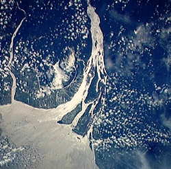
Gerald Meier, a consultant with the World Bank's hazard risk management group, said the project was responding to the catastrophic flooding in Guyana in 2005, which affected most of the inhabited northern coast of the country where up to 90 percent of the population lives.
WASHINGTON (Reuters) - The World Bank and Global Environmental Facility have approved $3.8 million in grant funding to protect low-lying coastal areas in Guyana threatened by rising sea levels, an official said on Friday.
This is the first project of its kind to be approved under the Global Environmental Facility's Special Climate Change Fund. It will look at ways to improve coastal drainage in the small South American country.
Gerald Meier, a consultant with the World Bank's hazard risk management group, said the project was responding to the catastrophic flooding in Guyana in 2005, which affected most of the inhabited northern coast of the country where up to 90 percent of the population lives.
He said the Conservancy Adaptation Project would collect technical data about the land and the rising seas that would help the government to make informed decisions on reducing Guyana's vulnerability to flooding.
!ADVERTISEMENT!
"The idea is to try and take the results of what we do on this and then parlay that onto additional investments on the part of other donors," Meier said in an interview.
The project will identify at least 10 key drainage systems and support construction work designed to increase drainage of the so-called East Demerara Water Conservancy system to the Demerara River by 35 percent.
Meier said sea levels around Guyana have risen about 1.7 feet since the 1950s, according to a tide gauge.
While the rising seas could be blamed on the effects of global climate warming, Meier said it could also be due to Guyana's location in northern South America that is affected by sediment deposits from the Amazon. The country, with a population estimated at about 769,000, is bordered by the Atlantic Ocean on the north, with Suriname as its neighbor to the east and Venezuela to the west. Guyana's southern border touches Brazil.
"We see a relative change in sea level with regard to their drainage window, but what's causing it, we're not in a position to say," he said, adding, "However, given global predictions, we'd be foolish to ignore (climate change) and so as part of the project in our design parameters, we're artificially anticipating that there will be a sea-level rise."
Using a computer model and an aircraft-guided remote sensing system, World Bank experts will be able to collect topographic data of how much of the land is sloping into the sea around Guyana. It will also establish how surface water could be drained and will look at how future development will impact drainage.
"The coastal topography of Guyana is very gently sloping and if someone just builds a mound around their house, that can have an impact on somebody else downstream," Meier added.
Caroline Anstey, the bank's country director for the Caribbean, said reducing Guyana's vulnerability to floods was critical for its economic stability.
"The consequences of climate change in Caribbean nations like Guyana will impose a heavy burden on the economies of the region, in particular on the poor," she added.
© Reuters2007All rights reserved


