Mangrove forests are one of the most important weapons in the fight against climate change. Not only do they directly store huge amounts of carbon, but they actively capture additional carbon dioxide from the atmosphere and sequester it in their soils. When mangroves are destroyed, huge quantities of carbon are released into the atmosphere, significantly contributing to greenhouse gas emissions. Yet, until recently, little research has been done to identify which mangrove forests store the most carbon and are therefore most important in combatting climate change. However, all this has changed, thanks to a new study showcasing a global map of carbon storage in mangrove forests.
Mangrove forests are one of the most important weapons in the fight against climate change. Not only do they directly store huge amounts of carbon, but they actively capture additional carbon dioxide from the atmosphere and sequester it in their soils. When mangroves are destroyed, huge quantities of carbon are released into the atmosphere, significantly contributing to greenhouse gas emissions. Yet, until recently, little research has been done to identify which mangrove forests store the most carbon and are therefore most important in combatting climate change. However, all this has changed, thanks to a new study showcasing a global map of carbon storage in mangrove forests.
!ADVERTISEMENT!
"These results can help guide decisions regarding priority areas for the conservation and rehabilitation of mangroves for climate change mitigation," said Mark Spalding, principle investigator on the project and marine scientist at The Nature Conservancy.
The map is the result of a new computer model built by biologists at Cambridge University, Staffordshire University and The Nature Conservancy, and is published in Conservation Letters . However, the map considers only aboveground biomass (i.e., the carbon stored in trees), and not the carbon stored in the roots and soil at this time.
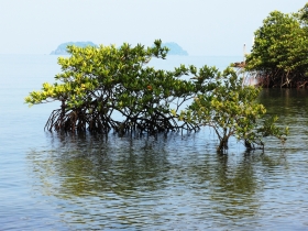
One of the most striking features of the map is that the amount of carbon stored by mangroves varies enormously between regions. The forests storing the most carbon are found in the equatorial tropics, especially in Southeast Asia, while those in more temperate regions have lower quantities of stored carbon.
"Our model showed that climatic conditions were major drivers of this variability, particularly the temperature, rainfall and seasonality," Spalding told mongabay.com. "Mangroves do well in warmer conditions, but they also flourish in slightly less saline waters, so while they will grow in the full salinity of the ocean they grow bigger in big deltas and estuaries. In insular Southeast Asia (and in a few parts of Africa and the Americas close to the equator) it is essentially wet year-round, and that counts for a lot."
"[Mangroves] form narrow coastal strips, or are patchy, broken up by rivers and channels. The presence of water also creates some challenges from mappers working from satellite images. Actually any look on Google Earth will show you that mangroves are very easy to see from space, so it is more a challenge of automated mapping over very large scales."
The researchers hope that this study and future research will provide leverage and increase awareness of the need to conserve mangroves.
Continue reading at ENN affiliate, MONGABAY.COM.
Mangroves image via Shutterstock.


