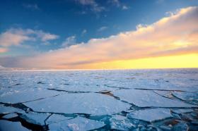
It's no surprise that Arctic sea ice is thinning. What is new is just how long, how steadily, and how much it has declined. University of Washington researchers compiled modern and historic measurements to get a full picture of how Arctic sea ice thickness has changed. The results, published this month in The Cryosphere, show a thinning in the central Arctic Ocean of 65 percent between 1975 and 2012. September ice thickness, when the ice cover is at a minimum, is 85 percent thinner for the same 37-year stretch.
It's no surprise that Arctic sea ice is thinning. What is new is just how long, how steadily, and how much it has declined. University of Washington researchers compiled modern and historic measurements to get a full picture of how Arctic sea ice thickness has changed.
The results, published this month in The Cryosphere, show a thinning in the central Arctic Ocean of 65 percent between 1975 and 2012. September ice thickness, when the ice cover is at a minimum, is 85 percent thinner for the same 37-year stretch.
"The ice is thinning dramatically," said lead author Ron Lindsay, a climatologist at the UW Applied Physics Laboratory. "We knew the ice was thinning, but we now have additional confirmation on how fast, and we can see that it's not slowing down."
The study helps gauge how much the climate has changed in recent decades, and helps better predict an Arctic Ocean that may soon be ice-free for parts of the year.
The project is the first to combine all the available observations of Arctic sea ice thickness. The earlier period from 1975 to 1990 relies mostly on under-ice submarines. Those records are less common since 2000, but have been replaced by a host of airborne and satellite measurements, as well as other methods for gathering data directly on or under the ice.
"A number of researchers were lamenting the fact that there were many thickness observations of sea ice, but they were scattered in different databases and were in many different formats," Lindsay said. The U.S. National Oceanic and Atmospheric Administration funded the effort to compile the various records and match them up for comparison.
The data also includes the NASA IceSat satellite that operated from 2003 to 2008, IceBridge aircraft-based measurements that NASA is conducting until its next satellite launches, long-term under-ice moored observations in the Beaufort Sea from the Woods Hole Oceanographic Institution, and other measures from aircraft and instruments anchored to the seafloor.
The older submarine records were unearthed for science by former UW professor Drew Rothrock, who used the U.S. Navy submarine measures of ice thickness to first establish the thinning of the ice pack through the 1990s. Vessels carried upward-looking sonar to measure the ice draft so they knew where they could safely surface. Further analysis of those records found a 36 percent reduction in the average thickness in the quarter century between 1975 and 2000.
Continue reading at EurekAlert!
Arctic ice image via Shutterstock.


