Coastal communities count on beaches for recreation and for protection from large waves, but beaches are vulnerable to threats such as erosion by storms and flooding. Whether beaches grow, shrink, or even disappear depends in part on what happens just offshore. How do features like shifting sandbars affect waves, currents, and the movement of sand from the beach to offshore and back?
Coastal communities count on beaches for recreation and for protection from large waves, but beaches are vulnerable to threats such as erosion by storms and flooding. Whether beaches grow, shrink, or even disappear depends in part on what happens just offshore. How do features like shifting sandbars affect waves, currents, and the movement of sand from the beach to offshore and back?
If we understand these processes well enough, scientists can include them in computer models of coastal change that can be used to forecast, for example, how the shoreline will react to severe storms and how it could change over years, decades, or even centuries. Coastal communities can use these forecasts to plan for storms, sea-level rise, changes in sand supply, and other threats.
“When a storm is on the way, it’s really powerful to be able to say: Here’s how the water and sand will move,” says Shawn Harrison, a U.S. Geological Survey (USGS) postdoctoral oceanographer.
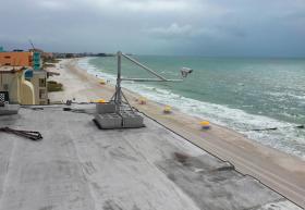
That’s why USGS scientists have installed video cameras pointed at beaches on the coast of western Florida and central California. They’re analyzing the videos to measure features of the beach and ocean so they can improve coastal-change forecasts.
Continue reading at United States Geological Survey (USGS).
Photo via USGS.


