On Sept. 29, 2009, an 8.1-magnitude earthquake struck near American Samoa, Samoa, and Tonga, triggering a tsunami that caused human casualties and $200 million in property damage on the islands.
On Sept. 29, 2009, an 8.1-magnitude earthquake struck near American Samoa, Samoa, and Tonga, triggering a tsunami that caused human casualties and $200 million in property damage on the islands. The earthquake also exacerbated another problem in American Samoa: subsidence, or the sinking of land. When combined with relative sea level rise, land sinking can increase the frequency and amount of coastal flooding.
Protecting against flooding on islands requires reliable measurements of how much the ground is sinking and where, said Jeanne Sauber, a geophysicist at NASA’s Goddard Space Flight Center in Greenbelt, Maryland. “You need to know in detail where the land is going down the fastest,” she said. Sauber and several NASA colleagues are combining remote sensing tools to figure that out.
Historically, subsidence measurements on small tropical islands have been difficult to make for two reasons. Islands often have few resources for acquiring detailed measurements at the land surface, and dense midday clouds and vegetation can make good satellite data difficult to get.
Read more at: NASA Goddard Space Flight Center
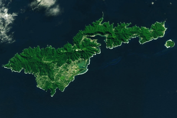
Landsat image of American Samoa’s Tutuila Island, acquired on July 22, 2022, with the Operational Land Imager (OLI) on Landsat 8. (Photo Credit: NASA Earth Observatory/Lauren Dauphin)


