Marine researchers have mapped the density of one of the most endangered large whale species worldwide, the North Atlantic right whale, using newly analyzed data to predict and help avoid whales’ harmful, even fatal, exposure to commercial fishing and vessel strikes.
Marine researchers have mapped the density of one of the most endangered large whale species worldwide, the North Atlantic right whale, using newly analyzed data to predict and help avoid whales’ harmful, even fatal, exposure to commercial fishing and vessel strikes.
Duke University’s Marine Geospatial Ecology Lab led a collaboration of 11 institutions in the United States that pooled 17 years of available visual survey data covering 9.7 million square kilometers of the U.S. Atlantic – roughly the same area as the entire contiguous United States.
This information was coupled with auditory data from almost 500 hydrophone recorders in US Atlantic waters that captured whales’ calls. Lining up visual and acoustic datasets for the first time, researchers built a statistical model to estimate the number of whales per square kilometer at different points in time. Researchers published their findings on March 20, 2024 in Marine Ecology Progress Series.
Read more at: Duke University
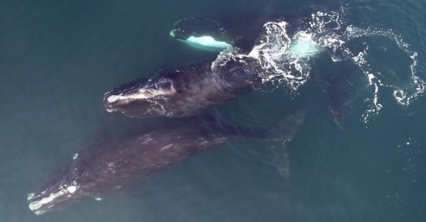
Three right whales observed from the air. (NMFS permit #21482 2) (Photo Credit: Mark Cotter/HDR)


