
ScienceDaily (July 21, 2010) — Using NASA satellite data, scientists have produced a first-of-its kind map that details the height of the world's forests. Although there are other local- and regional-scale forest canopy maps, the new map is the first that spans the entire globe based on one uniform method.
ScienceDaily (July 21, 2010) — Using NASA satellite data, scientists have produced a first-of-its kind map that details the height of the world's forests. Although there are other local- and regional-scale forest canopy maps, the new map is the first that spans the entire globe based on one uniform method.
!ADVERTISEMENT!
The work -- based on data collected by NASA's ICESat, Terra, and Aqua satellites -- should help scientists build an inventory of how much carbon the world's forests store and how fast that carbon cycles through ecosystems and back into the atmosphere. Michael Lefsky of the Colorado State University described his results in the journal Geophysical Research Letters.
The new map shows the world's tallest forests clustered in the Pacific Northwest of North America and portions of Southeast Asia, while shorter forests are found in broad swaths across northern Canada and Eurasia. The map depicts average height over 5 square kilometers (1.9 square miles) regions), not the maximum heights that any one tree or small patch of trees might attain.
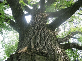
Temperate conifer forests -- which are extremely moist and contain massive trees such as Douglas fir, western hemlock, redwoods, and sequoias--have the tallest canopies, soaring easily above 40 meters (131 feet). In contrast, boreal forests dominated by spruce, fir, pine, and larch had canopies typically less than 20 meters (66 feet). Relatively undisturbed areas in tropical rain forests were about 25 meters (82 feet), roughly the same height as the oak, beeches, and birches of temperate broadleaf forests common in Europe and much of the United States.
Scientific interest in the new map goes far beyond curiosities about tree height. The map has implications for an ongoing effort to estimate the amount of carbon tied up in Earth's forests and for explaining what sops up 2 billion tons of "missing" carbon each year.
Humans release about 7 billion tons of carbon annually, mostly in the form of carbon dioxide. Of that, 3 billion tons end up in the atmosphere and 2 billion tons in the ocean. It's unclear where the last two billion tons of carbon go, though scientists suspect forests capture and store much of it as biomass through photosynthesis.
There are hints that young forests absorb more carbon than older ones, as do wetter ones, and that large amounts of carbon end up in certain types of soil. But ecologists have only begun to pin down the details as they try to figure out whether the planet can continue to soak up so much of our annual carbon emissions and whether it will continue to do so as climate changes.
Article continues: http://www.sciencedaily.com/releases/2010/07/100720162306.htm


