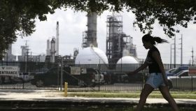
A new study examined concentrations of polycyclic aromatic hydrocarbons (PAHs) before and after Hurricane Harvey in the Houston environmental justice neighborhood of Manchester.

A new study examined concentrations of polycyclic aromatic hydrocarbons (PAHs) before and after Hurricane Harvey in the Houston environmental justice neighborhood of Manchester.
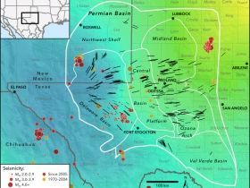
A seismic stress map created by Stanford geophysicists can help predict which parts of West Texas and New Mexico may be at risk of fracking-induced earthquakes. The map could guide oil discovery efforts in the region.
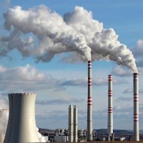
Removing fossil fuel subsidies would have only a small effect on CO2 emissions and renewable energy use, new research has shown. The largest emissions savings would be in oil and gas exporting countries, where fewer poor people would be affected, and subsidy removal can be aided by currently low oil prices.
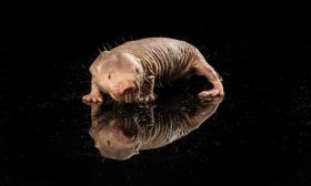
With their large buck teeth and wrinkled, hairless bodies, naked mole rats won’t be winning any awards for cutest rodent. But their long life span—they can live up to 30 years, the longest of any rodent—and remarkable resistance to age-related diseases, offer scientists key clues to the mysteries of aging and cancer.
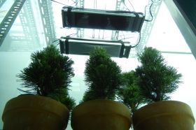
Pine trees become temporarily sterile when exposed to ultraviolet radiation as intense as some scientists believe the Earth experienced 252 million years ago during the planet’s largest mass extinction, lending support to the theory that ozone depletion contributed to the crisis.
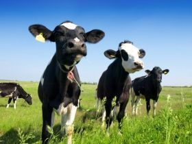
Some calves are inherently optimistic or pessimistic, just as humans are, a new University of British Columbia study has found.
Recognizing these individual personality differences is important to ensure animals are treated well, says professor Marina von Keyserlingk, who led the research team from UBC’s animal welfare program in the faculty of land and food systems.


