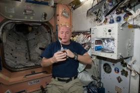
You may think you’re just an average Joe, but according to your metabolomics data your body is percolating some expressive information about your daily life.

You may think you’re just an average Joe, but according to your metabolomics data your body is percolating some expressive information about your daily life.
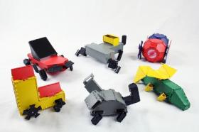
Even as robots become increasingly common, they remain incredibly difficult to make. From designing and modeling to fabricating and testing, the process is slow and costly: Even one small change can mean days or weeks of rethinking and revising important hardware.
But what if there were a way to let non-experts craft different robotic designs — in one sitting?
Researchers from MIT’s Computer Science and Artificial Intelligence Laboratory (CSAIL) are getting closer to doing exactly that. In a new paper, they present a system called “Interactive Robogami” that lets you design a robot in minutes, and then 3-D print and assemble it in as little as four hours.
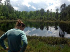
In recent decades, change has defined our environment in the United States. Agriculture intensified. Urban areas sprawled. The climate warmed. Intense rainstorms became more common. But, says a new University of Wisconsin–Madison study, while those kinds of changes usually result in poor water quality, lakes have surprisingly stayed the same.
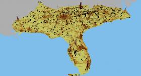
New mapping methods developed by researchers at the Department of Energy’s Oak Ridge National Laboratory can help urban planners minimize the environmental impacts of cities’ water and energy demands on surrounding stream ecologies.
In an analysis published in Proceedings of the National Academy of Sciences, an ORNL-led team used high-resolution geospatial modeling to quantify the effects of land, energy, and water infrastructures on the nation’s rivers and streams.

Seismologists investigating how Earth forms new continental crust have compiled more than 20 years of seismic data from a wide swath of South America’s Andean Plateau and determined that processes there have produced far more continental rock than previously believed.
A fast, simple blood test for ulcerative colitis using infrared spectroscopy could provide a cheaper, less invasive alternative for screening compared to colonoscopy, which is now the predominant test, according to a study between the Department of Physics and Astronomy and the Institute for Biomedical Sciences at Georgia State University.


