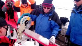
Tropical Storm Nesat formed early on July 26 just east of the Philippines and NASA's Aqua satellite passed overhead gathering temperature data to determine the location of the most powerful storms. Imagery showed strong storms from Nesat's western side were affecting the central Philippines.

Infrared satellite imagery from the Atmospheric Infrared Sounder or AIRS instrument that flies aboard NASA's Aqua satellite taken on July 26 at 0529 UTC (1:29 a.m. EDT) provided a look at the temperatures of Nesat’s clouds. That data was false colored and made into an image at NASA's Jet Propulsion Laboratory in Pasadena, California to highlight cloud top temperatures.

Read more ...

MOTORISTS face rush-hour bans and pollution taxes in up to 17 towns and cities across the UK as the Government vows to clean up the ‘dirtiest roads’ in Britain.

Environment Secretary Michael Gove will pave the way for local authorities to slap yet more tax on drivers as part of his radical blueprint.

His plans reveal that air pollution needs to be addressed on 81 roads – 33 of which are outside London such as the A360 in Sheffield or A35 in Southampton.

Nitrogen dioxide emissions along each of them breach the legal limit.

Mr Gove will insist that councils first exhaust all other possible options to improve air quality, such as tackling chronic congestion.

Read more ...

A lonely bird call breaks my concentration and I glance upward. Where glacier-topped mountains should be filling the horizon, instead my view is obscured by a strange orange haze. Even the bright sun has given up. It seems to float in the sky as a faint pink ball.

I am a field ecologist working east of the Denali mountain range in Alaska, but the postcard-worthy view of my sites today is obscured by smoke drifting across the border from wildfires burning throughout British Columbia. I have been studying boreal wildfires for years and have a strong understanding of the importance of fire to the boreal forest of Canada.

Read more ...

More Articles ...

Subcategories