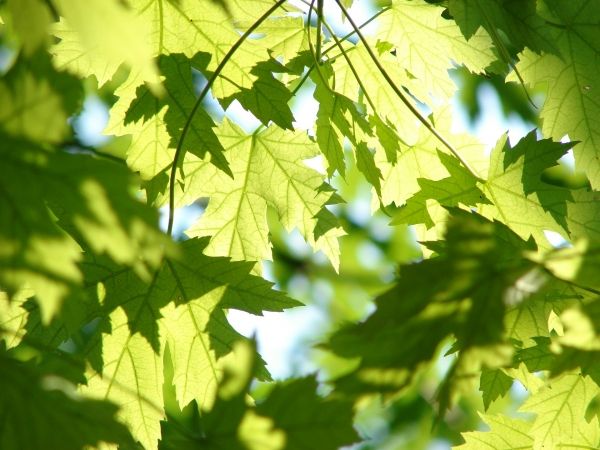
Repeated pooling and evaporation of water built this expansive salt pan in northern Namibia.

Almost all of the 46 centimeters (18 inches) of rain that falls in Etosha National Park each year arrives between October and March. The influx of moisture—a boon for the wildlife—completely transforms the landscape. It greens parched grasslands, replenishes ephemeral streams and watering holes, and sometimes pools enough to cover a flat basin with a layer of water that extends for thousands of square kilometers.

When the rains slow and then cease during the dry season (April through September), any water in the basin slowly evaporates, depositing salt and other minerals on the land surface in the process. Over time, this cycle of flooding and evaporation has built up a mineral-encrusted surface called a salt pan. In fact, the striking white surface of the salt pan is what originally earned Etosha Pan its name. In the language of the local Ovambo people, etosha means "great white place."

Continue reading at NASA Earth Observatory

Image via NASA Earth Observatory

Read more ...

NASA-NOAA’s Suomi NPP satellite provided an infrared image of Tropical Depression 20 in that helped confirm it organized and strengthened into Tropical Storm Teddy.

Teddy, which has broken a hurricane season record, is expected to become a major hurricane later in the week, according to the National Hurricane Center (NHC).

Tropical Depression 20 formed late on Saturday, Sept. 12 in the Central North Atlantic Ocean, about 2,030 miles (3,265 km) east of the Northern Leeward Islands. It maintained tropical depression status until this morning, Sept. 14, when infrared satellite data helped confirm it had strengthened and organized. NHC reported this makes Tropical Storm Teddy the earliest 19th named storm, besting the unnamed tropical storm on October 4, 2005.

Continue reading at NASA Goddard Space Flight Center

Image via NASA Goddard Space Flight Center

Read more ...

Tropical Storm Sally was deemed a hurricane on Sept. 14 just after NASA’s Aqua satellite provided data on the storm.

On Sunday, Sept. 13, NASA analyzed Sally’s cloud top temperatures to gauge if the storm was strengthening. Cloud top temperatures provide information to forecasters about where the strongest storms are located within a tropical cyclone. The stronger the storms, the higher they extend into the troposphere, and the colder the cloud temperatures.

On Sept. 13 at 2:35 p.m. EDT (1835 UTC) NASA’s Aqua satellite analyzed Tropical Storm Sally using the Atmospheric Infrared Sounder or AIRS instrument. AIRS found coldest cloud top temperatures as cold as or colder than minus 63 degrees Fahrenheit (minus 53 degrees Celsius) around the center and east of the center. NASA research has shown that cloud top temperatures that cold indicate strong storms that have the capability to create heavy rain.

Continue reading at NASA Goddard Space Flight Center

Image via NASA Goddard Space Flight Center

Read more ...

More Articles ...

Subcategories