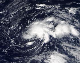
Tropical Storm Ophelia developed on Oct. 9 around 5 a.m. EDT as the seventeenth, tropical depression of the Atlantic Ocean hurricane season. It formed in the Central Atlantic Ocean about 875 miles (1,405 km) west-southwest of the Azores islands. NASA's Terra satellite provided forecasters with a visible image of the storm as it strengthened into a tropical storm.