
Barry, now a tropical depression, continues moving slowly north through Arkansas and rainfall and flooding remains a concern.
Barry, now a tropical depression, continues moving slowly north through Arkansas and rainfall and flooding remains a concern. NASA-NOAA’s Suomi NPP satellite passed over the south central United States yesterday, July 14 and captured a visible image of then Tropical Storm Barry.
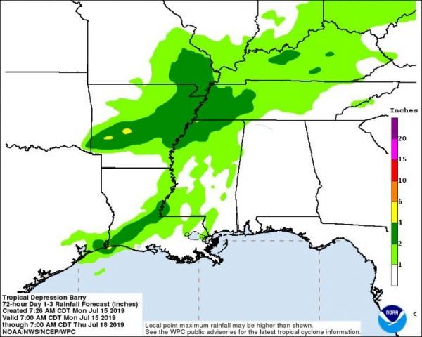
Tropical Storm Barry tracked through northwestern Louisiana on July 14, and weakened to a tropical depression. On its track, Barry dropped up to 15 inches (38 cm) of rain in some isolated placed. Barry’s rainfall created flooding along the Mississippi River.
The Visible Infrared Imaging Radiometer Suite (VIIRS) instrument aboard Suomi NPP provided a visible image of the storm on July 14 after it moved inland over Louisiana. The VIIRS image showed an elongated storm over Louisiana stretching over the Mississippi River Valley and into Arkansas, Mississippi, western Alabama and southwestern Tennessee.
Read more at NASA / Goddard Space Flight Center
Image: NASA-NOAA’s Suomi NPP satellite provided a visible image of Barry on July 14 after it moved inland over Louisiana. The VIIRS image showed an elongated storm over Louisiana stretching over the Mississippi River Valley and into Arkansas, Mississippi, western Alabama and southwestern Tennessee. Credit: NASA Worldview, Earth Observing System Data and Information System (EOSDIS).


