
Tropical Depression 17 strengthened briefly into a tropical storm on the same day it formed, Oct. 25. NASA’s Terra satellite captured a look at the clouds associated with its remnants merging with a cold front over the southern U.S.
Tropical Depression 17 strengthened briefly into a tropical storm on the same day it formed, Oct. 25. NASA’s Terra satellite captured a look at the clouds associated with its remnants merging with a cold front over the southern U.S.
Tropical Depression 17 formed early on Friday, Oct. 25 and by 5 p.m. EDT it had strengthened and organized into a tropical storm and was renamed Olga. However, by 11 p.m. EDT, Olga transitioned again into a post-tropical storm.
The last advisory on Tropical Storm Olga was issued at 11 p.m. EDT on Oct. 25 by the National Hurricane Center or NHC. At that time, the center of Post-Tropical Cyclone Olga was located near latitude 27.8 degrees north and longitude 92.2 degrees west. The post-tropical cyclone was moving toward the northeast near 17 mph (28 kph) and maximum sustained winds were near 50 mph (85 kph) and weakening.
Read more at NASA / Goddard Space Flight Center
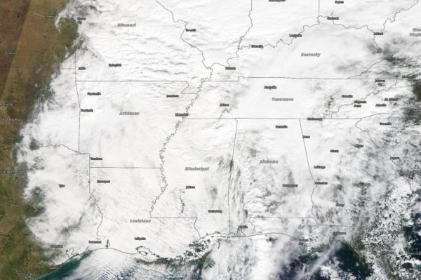
Image: When NASA’s Terra satellite passed over the eastern U.S. on Oct. 26, it found post-tropical cyclone Olga’s clouds spreading into the Mississippi Valley, but there was no discernable center of circulation as the storm became embedded in a cold front. Credit: NASA Worldview


