
In the U.S., we may often think of landslides as primarily a West Coast problem, mostly plaguing the mountainous terrain of California, Oregon, and Washington.
In the U.S., we may often think of landslides as primarily a West Coast problem, mostly plaguing the mountainous terrain of California, Oregon, and Washington. A technical session at the upcoming GSA 2023 Joint Southeastern & Northeastern Section Meeting in Reston, Virginia, USA, will highlight the major impacts of landslides on the U.S. East Coast and what is being done to save lives and deal with the damages.
Landslides are projected to be a growing concern as climate change produces more extreme rainfall events that can destabilize slopes and trigger these events. Research presented in the session will include investigations of landslide hazards in Puerto Rico, Vermont, Pennsylvania, Michigan, Tennessee, West Virginia, and southern and central Appalachia.
Puerto Rico
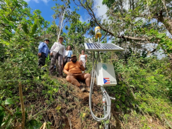
After Hurricane Maria in 2017, researchers documented more than 70,000 landslides on the island of Puerto Rico. Geologist Stephen Hughes at the University of Puerto Rico Mayagüez saw a gap in the monitoring and forecasting of landslides on the island, and to fill that gap he started a research and outreach program: Storm-induced Landslide Impact Dynamics on Environment and Society in Puerto Rico (SLIDES-PR). Through partnership with the U.S. Geological Survey, SLIDES-PR has developed a landslide susceptibility map for the island and installed 14 real-time monitoring stations on landslide-prone slopes.
Read more at Geological Society of America
Image: New installation of a slope monitoring station in Yauco, Puerto Rico, by a SLIDES-PR team. (Source: Stephen Hughes)


