
Everyone knows that exercise is good for you, but what type of training helps most, especially when you’re older - say over 65? A Mayo Clinic study says it’s high-intensity aerobic exercise, which can reverse some cellular aspects of aging. The findings appear in Cell Metabolism.
Mayo researchers compared high-intensity interval training, resistance training and combined training. All training types improved lean body mass and insulin sensitivity, but only high-intensity and combined training improved aerobic capacity and mitochondrial function for skeletal muscle. Decline in mitochondrial content and function are common in older adults.
>> Read the Full Article
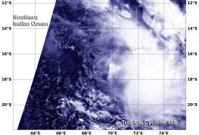
Tropical Cyclone 11S appeared elongated in NASA satellite imagery as a result of the storm being battered by wind shear.
When NASA's Terra satellite flew over Tropical Cyclone 11S on March 10 at 0515 UTC (12:15 a.m. EST) the Moderate Resolution Imaging Spectroradiometer or MODIS instrument took a visible light picture of the storm. The image revealed that the storm has been stretched out by moderate vertical wind shear.
>> Read the Full Article
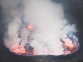
There is no mint that can take the edge off sulfurous emissions from volcanoes, but researchers can use remote sensing to better understand volcanic breathing.
Volcanoes erupt, they spew ash, their scarred flanks sometimes run with both lava and landslides. But only occasionally. A less dramatic but important process is continuous gas emissions from volcanoes; in other words, as they exhale. A number of volcanoes around the world continuously exhale water vapor laced with heavy metals, carbon dioxide, hydrogen sulfide and sulfur dioxide, among many other gases. Of these, sulfur dioxide is the easiest to detect from space.
>> Read the Full Article
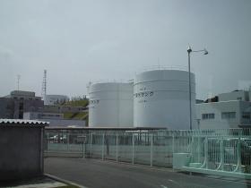
The 2011 Fukushima catastrophe is an ongoing disaster whose end only gets more remote as time passes. The government is desperate to get evacuees back into their homes for the 2020 Tokyo Olympics, but the problems on the ground, and in the breached reactor vessels, are only getting more serious and costly, as unbelievable volumes of radiation contaminate land, air and ocean.
>> Read the Full Article
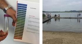
With their measurements and samples, nearly 3,500 schoolchildren have assisted a research study on lakes and global warming, now published in an academic journal. The results show that water temperatures generally remain low despite the air becoming warmer. This helps to curb the outflow of greenhouse gases.
>> Read the Full Article
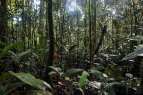
Conservationists working to safeguard tropical forests often assume that old growth forests containing great stores of carbon also hold high biodiversity, but a new study finds that the relationship may not be as strong as once thought, according to a group of researchers with contributions from WCS (Wildlife Conservation Society) and other organizations.
Tropical forests are exceptionally rich in both carbon and biodiversity, but the study recently published in the journal Scientific Reports indicates that, within the tropics, tree diversity and forest carbon do not necessarily correlate, and that there is no detectable relationship between the two factors across a region, a scale relevant for conservation planning and the establishment of protected areas. For instance, in Central Africa, some areas that are dominated by one or a few tree species are high in carbon density, whereas some forests with many more tree species have a lower carbon density.
>> Read the Full Article
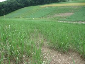
Growing sustainable energy crops without increasing greenhouse gas emissions, may be possible on seasonally wet, environmentally sensitive landscapes, according to researchers who conducted a study on Conservation Reserve Program (CRP) land.
Debasish Saha, postdoctoral scholar in plant sciences, Penn State College of Agricultural Sciences, and colleagues measured the amount of nitrous oxide, a potent greenhouse gas, emanating from plots of biofuels-producing switchgrass — a native perennial grass — and miscanthus — a non-native grass species — growing in an experimental area in eastern central Pennsylvania and compared it to emissions from adjacent, undisturbed CRP acres. The experiment took place in a long-term monitoring site managed by the U.S. Department of Agriculture's Agricultural Research Service.
>> Read the Full Article
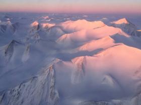
For the past eight years, Operation IceBridge, a NASA mission that conducts aerial surveys of polar ice, has produced unprecedented three-dimensional views of Arctic and Antarctic ice sheets, providing scientists with valuable data on how polar ice is changing in a warming world. Now, for the first time, the campaign will expand its reach to explore the Arctic’s Eurasian Basin through two research flights based out of Svalbard, a Norwegian archipelago in the northern Atlantic Ocean.
>> Read the Full Article


