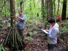
The past few decades have seen the rise of global incentive programs offering payments to landowners to help reduce tropical deforestation. Until now, assessments of these programs have largely overlooked decreases in forest diversity. In what might be a first of its kind study, University of Missouri researchers have integrated forest imaging with field-level inventories and landowner surveys to assess the impact of conservation payments in Ecuador’s Amazon Basin forests. They found that conservation payment programs are making a difference in the diversity of tree species in protected spaces. Further, the species being protected are twice as likely to be of commercial timber value and at risk of extinction.
>> Read the Full Article
Producers sometimes face challenges that go deep into the soil. They need answers to help the soil, on site. A portable field sensor can accurately measure minerals in soils more easily and efficiently than existing methods. And a research team, including a middle school student and her scientist father, can confirm it.
>> Read the Full Article
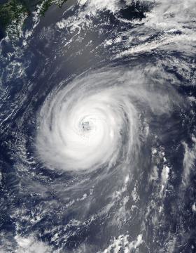
NASA’s Aqua satellite is keeping track of Typhoon Noru as it continues its slow trek through the Northwestern Pacific Ocean.
On August 2, 2017 at 12:05 a.m. EDT (0405 UTC) the Moderate Resolution Imaging Spectroradiometer or MODIS instrument that flies aboard NASA’s Aqua satellite captured a visible image of Typhoon Noru. The MODIS image shows a symmetric band of thunderstorms completely surrounding a well-defined eye feature.
>> Read the Full Article
Scientists at the University of York have shown that using historical wildlife data provides a more accurate measure of how vulnerable certain species might be to extinction from climate change.
Some of the methods used to predict at risk species are trend-based – an indicator of what happens gradually over time – while others are trait based, which uses signs of climate change in the current environment.
>> Read the Full Article
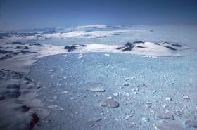
The largest remaining ice shelf on the Antarctic Peninsula lost 10% of its area when an iceberg four times the size of London broke free earlier this month.
Since the 12 July 2017 breakaway Dr Anna Hogg, from the University of Leeds, and Dr Hilmar Gudmundsson, from the British Antarctic Survey (BAS), have continued to track the iceberg – known as A68 – using the European Space Agency (ESA) and European Commission’s Copernicus Sentinel-1 satellite.
>> Read the Full Article


