
NASA’s Aqua Satellite provided a visible image of Tropical Storm Humberto as it was strengthening off the Florida coast on Sept. 15.
NASA’s Aqua Satellite provided a visible image of Tropical Storm Humberto as it was strengthening off the Florida coast on Sept. 15. Humberto became a hurricane late in the day.
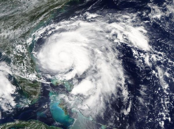
On Sept. 15, the Moderate Imaging Spectroradiometer or MODIS instrument that flies aboard NASA’s Aqua satellite provided a visible image of Tropical Storm Humberto spinning off the eastern coast of Florida and strengthening. Powerful thunderstorms circled the center and a large band of thunderstorms wrapped into the low-level center from the east. Humberto became a hurricane on Sept. 15 at 11 p.m. EDT.
Earlier that day at 2:11 p.m. EDT (1811 UTC) the Atmospheric Infrared Sounder (AIRS) instrument aboard NASA’s Aqua satellite analyzed Humberto’s cloud top temperatures in infrared light. AIRS found coldest cloud top temperatures (purple) of strongest thunderstorms were as cold as or colder than minus 63 degrees Fahrenheit (minus 53 degrees Celsius) around the center. NASA research has shown that storms with cloud top temperatures that cold can produce heavy rainfall.
Read more at NASA / Goddard Space Flight Center
Image: On Sept. 15, the MODIS instrument that flies aboard NASA’s Aqua provided a visible image of Tropical Storm Humberto spinning off the eastern coast of Florida and strengthening. Powerful thunderstorms circled the center and a large band of thunderstorms wrapped into the low-level center from the east. Credit: NASA Worldview, Earth Observing System Data and Information System (EOSDIS).


