
As Tropical Depression 28W continued organizing and developing into Tropical Storm Fung-Wong in the Philippine Sea, NASA’s Aqua satellite provided data on the storm to forecasters.
As Tropical Depression 28W continued organizing and developing into Tropical Storm Fung-Wong in the Philippine Sea, NASA’s Aqua satellite provided data on the storm to forecasters. In the Philippines, Fung-Wong is known as Sarah.
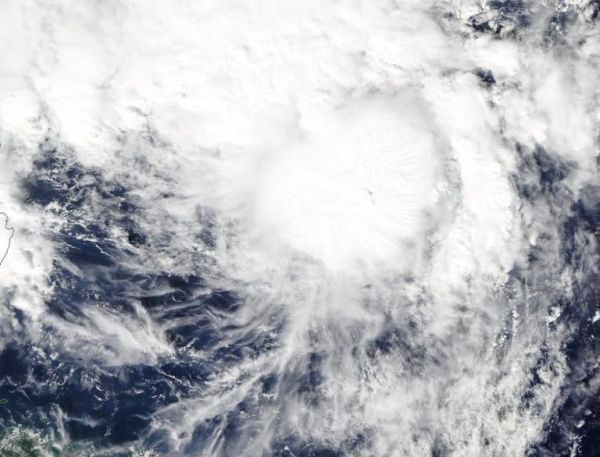
On Nov. 20, the Moderate Resolution Imaging Spectroradiometer or MODIS instrument that flies aboard NASA’s Aqua satellite provided a visible image on Fung-Wong. The image indicated that the circulation center was more well-defined. A band of thunderstorms was also seen on the eastern side of the storm.
The shape of the storm is a clue to forecasters that a storm is either strengthening or weakening. If a storm takes on a more rounded shape it is getting more organized and strengthening. Conversely, if it becomes less rounded or elongated, it is a sign the storm is weakening. Fung-Wong has appeared to become more symmetrical in the MODIS imagery, indicating it is getting better organized.
In addition, the Joint Typhoon Warning Center noted that animated enhanced infrared satellite imagery suggests the low-level circulation center is obscured under central dense overcast. The deep convection (bands of thunderstorms) appears to have begun wrapping completely around the low-level center of circulation.
Read more at NASA / Goddard Space Flight Center
Image: On Sept. 19, the MODIS instrument that flies aboard NASA’s Aqua satellite took this image of Tropical Storm Fung-Wong while it continued organizing in the Philippine Sea. Credit: NASA Worldview


