
The salt marshes that rim the shores of Massachusetts's Plum Island estuary, which provide nesting grounds for numerous waterfowl and extremely productive spawning grounds for striped bass and soft-shell clams, have grown by 300 hectares in the last 300 years. That growth, according to a new study, was fueled by post-colonial deforestation and the erosion it caused in areas upstream. The findings suggests that efforts to maintain or restore salt marshes along the Eastern Seaboard, which have begun to disappear in recent years for a variety of reasons, may be preventing the wetlands from returning to their more natural sizes. In the past century, wetlands in many regions have shrunk dramatically. San Francisco Bay lost about 20,000 hectares of wetlands during that period, and the Mississippi River delta lost 20 times that amount. Scientists have long presumed that the ongoing loss of wetlands in many areas of the world stems from influences such as rising sea levels and human development of coastal real estate. In many regions, dams both large and small also contribute to wetland degradation by interrupting the flow of sediment to the sea, thereby depriving the marshes of material that could accumulate and help counteract local erosion.
The salt marshes that rim the shores of Massachusetts's Plum Island estuary, which provide nesting grounds for numerous waterfowl and extremely productive spawning grounds for striped bass and soft-shell clams, have grown by 300 hectares in the last 300 years. That growth, according to a new study, was fueled by post-colonial deforestation and the erosion it caused in areas upstream. The findings suggests that efforts to maintain or restore salt marshes along the Eastern Seaboard, which have begun to disappear in recent years for a variety of reasons, may be preventing the wetlands from returning to their more natural sizes.
!ADVERTISEMENT!
In the past century, wetlands in many regions have shrunk dramatically. San Francisco Bay lost about 20,000 hectares of wetlands during that period, and the Mississippi River delta lost 20 times that amount. Scientists have long presumed that the ongoing loss of wetlands in many areas of the world stems from influences such as rising sea levels and human development of coastal real estate.
In many regions, dams both large and small also contribute to wetland degradation by interrupting the flow of sediment to the sea, thereby depriving the marshes of material that could accumulate and help counteract local erosion.
But in some areas, the 20th-century shrinkage of wetlands may simply be a return toward normal coverage, argue Matthew Kirwan, a geomorphologist with the U.S. Geological Survey in Charlottesville, Virginia, and colleagues. They draw that conclusion from their study of the Plum Island estuary reported in the May issue of Geology.
By carbon-dating peat samples taken in 2006 from more than a dozen places in those marshes, Kirwan and his colleagues found that 3 centuries ago the wetlands covered only about 2/3 their current area. Mainly during the 1700s and 1800s, the salt marshes expanded atop a temporary bounty of sediment delivered to the estuary's shores as a result of human-induced erosion, the researchers contend. The area was first settled in the 1630s, and by 1700 at least three of the rivers flowing into the estuary powered sawmills and gristmills—evidence of the substantial deforestation and agricultural activity taking place in the watershed, Kirwan notes.
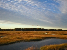
Photo credit: USGS, http://soundwaves.usgs.gov/2011/01/research3.html
Article continues: http://news.sciencemag.org/sciencenow/2011/04/colonial-era-erosion-may-have.html


