
Where will the water be? That is the critical question for the future as climate changes occur forcing water to change its habits. Climate change projections indicate a steady increase in temperature progressing through the 21st century, generally resulting in snow pack reductions, changes to the timing of snow melt, altered stream flows, and reductions in soil moisture, all of which could affect water management, agriculture, recreation, hazard mitigation, and ecosystems across the nation. Despite some widespread similarities in climate change trends, climate change will affect specific water basins in the U.S. differently, based on the particular hydrologic and geologic conditions in that area.
Where will the water be? That is the critical question for the future as climate changes occur forcing water to change its habits. Climate change projections indicate a steady increase in temperature progressing through the 21st century, generally resulting in snow pack reductions, changes to the timing of snow melt, altered stream flows, and reductions in soil moisture, all of which could affect water management, agriculture, recreation, hazard mitigation, and ecosystems across the nation. Despite some widespread similarities in climate change trends, climate change will affect specific water basins in the U.S. differently, based on the particular hydrologic and geologic conditions in that area.
!ADVERTISEMENT!
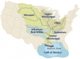
A drainage basin is an extent or an area of land where surface water from rain and melting snow or ice converges to a single point, usually the exit of the basin, where the waters join another water body, such as a river, lake, reservoir, estuary, wetland, sea, or ocean. In closed drainage basins the water converges to a single point inside the basin, known as a sink, which may be a permanent lake, dry lake, or a point where surface water is lost underground. The drainage basin includes both the streams and rivers that convey the water as well as the land surfaces from which water drains into those channels, and is separated from adjacent basins by a drainage divide
New USGS modeling studies project changes in water availability due to climate change at the local level. So far, the USGS has applied these models to fourteen basins:
Sprague River Basin, Oregon
Sagehen Creek Basin, California
Feather River Basin, California
Naches River Basin, Washington
Yampa River Basin, Colorado
East River Basin, Colorado
Black Earth Creek Basin, Wisconsin
Flint River Basin, Georgia
Pomperaug River Watershed, Connecticut
Clear Creek Basin, Iowa
Cathance Stream Basin, Maine
Trout Lake Basin, Wisconsin
Starkweather Coulee Basin, North Dakota
South Fork of the Flathead River, Montana
"The advantage of these studies is that they demonstrate that there is not just one hydrological response to climate change: the predictions account for essential local factors that will govern the timing, severity, and type of impact, whether it be water shortage, drought, or flood," said USGS Director Marcia McNutt.
These local projections are based on General Circulation Models (GCM) that predict how climate change will affect temperature, precipitation, and emissions for large regional areas. The USGS’s Precipitation Runoff Modeling System (PRMS) applies information from the down scaled GCM projections to local watersheds, where impacts of climate change on water availability will depend on local conditions. These local-scale hydrologic projections will allow managers to plan for changes in water resources that are specific to their area.
For example, the Sprague River is located in the northeastern headwaters of the Klamath River and drains a semiarid basin of 4,053 square kilometers (km2). Mean annual precipitation (1961–1990), spatially averaged over the basin, is 51 centimeters. Snowfall comprises about 30 and 50 percent of annual precipitation in the valley lowlands and the higher elevations, respectively.
The USGS model project that changes to snow pack in the Sprague River Basin in Oregon could cause annual peak streamflows to occur earlier in the spring as overall basin storage decreases, which may force managers to modify storage operation and reprioritize water deliveries for environmental and human needs.
Reduced snowpack in headwaters of the Colorado River could affect the amount and timing of streamflow to the Colorado River and also impact important recreation areas.
Portions of Maine may see higher stream flows which could affect populations of endangered Atlantic salmon.
Areas of the already drought-stressed Flint River Basin, one of Atlanta’s primary drinking water supplies, are projected to become even drier.
The results for each basin present a complex story due to uncertainty associated with the future climate projections and their effect on the hydrological response of the different geographical regions of the nation.
Detailed information about watershed responses to climate change can be found online. Additionally, a collection of USGS studies that contributed to these basin-wide analyses was published in the journal Earth Interactions.
These USGS models are just one of several tools developed and used by agencies within the Department of the Interior to study potential impacts from climate change and to provide tools to resource managers to adapt to those changes. For example, the Bureau of Reclamation recently unveiled a user-friendly tool for calculating future stream flow and water supplies at 195 sites in the western United States to help increase accessibility of science-based information and ease understanding of how climate variations will impact water availability for local communities.
For further information and other studies go to USGS.
Watershed image via Wikipedia.


