
The United States Geological Survey and the Department of Defense Task Force for Business and Stability Operations in Afghanistan have worked together to map out the natural resources in Afghanistan. In particular, the map will be used for the development of the country's economically viable minerals. For the first time in history, a country is being mapped using an advanced remote sensing technique known as hyperspectral imaging. At this point, 70 percent of Afghanistan has been mapped with this technique. This effort will hopefully lead to the economic development to one of the poorest and most volatile places on Earth.
The United States Geological Survey and the Department of Defense Task Force for Business and Stability Operations in Afghanistan have worked together to map out the natural resources in Afghanistan. In particular, the map will be used for the development of the country's economically viable minerals. For the first time in history, a country is being mapped using an advanced remote sensing technique known as hyperspectral imaging. At this point, 70 percent of Afghanistan has been mapped with this technique. This effort will hopefully lead to the economic development to one of the poorest and most volatile places on Earth.
!ADVERTISEMENT!
The map was created using airborne hyperspectral sensors measuring light reflected from the earth. The spectrum of reflected light is interpreted to identify the composition of materials on the surface. This includes minerals as well as man-made structures, vegetation, and snow. The benefit of this method is that it allows large areas to be mapped quickly and accurately.
The DOD task force has been working with the Afghan Government’s Ministry of Mines to identify major mineral deposits for international mining companies. According to USGS Director, Marcia McNutt, "Hyperspectral sensors deployed from aircraft are the ideal tool for mapping the mineral provinces of a nation with rugged topographic relief and lack of substantial ground cover. When compared with conventional ground mapping, use of this technology has accelerated by decades the identification of the most promising areas for economic development in Afghanistan."
Developing the maps took substantial computer power. Over 800 million pixels of data were generated, collected over 43 days and 28 flights, and approximately 170,000 square miles.
The Afghan government is using the data to develop information packages to attract businesses to the country. The United States military will not be around forever to prop up its weak economy, and this war-ravaged nation will need all the help it can get.
The new hyperspectral maps of Afghanistan are available online. There are two maps:
Surface Materials Map of Afghanistan: Iron-bearing Minerals and Other Materials
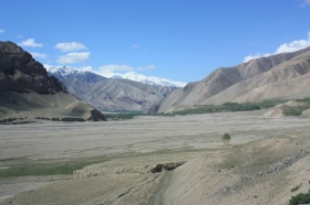
Afghanistan Mountains image via Shutterstock


