
Research using NASA data is giving new insight into one of the processes causing Greenland's ice sheet to lose mass. A team of scientists used satellite observations and ice thickness measurements gathered by NASA's Operation IceBridge to calculate the rate at which ice flows through Greenland's glaciers into the ocean. The findings of this research give a clearer picture of how glacier flow affects the Greenland Ice Sheet and shows that this dynamic process is dominated by a small number of glaciers.
Research using NASA data is giving new insight into one of the processes causing Greenland's ice sheet to lose mass. A team of scientists used satellite observations and ice thickness measurements gathered by NASA's Operation IceBridge to calculate the rate at which ice flows through Greenland's glaciers into the ocean. The findings of this research give a clearer picture of how glacier flow affects the Greenland Ice Sheet and shows that this dynamic process is dominated by a small number of glaciers.
!ADVERTISEMENT!
Over the past few years, Operation IceBridge measured the thickness of many of Greenland's glaciers, which allowed researchers to make a more accurate calculation of ice discharge rates. In a new study published in the journal Geophysical Research Letters, researchers calculated ice discharge rates for 178 Greenland glaciers more than one kilometer (0.62 miles) wide.
Ice sheets grow when snow accumulates and is compacted into ice. They lose mass when ice and snow at the surface melts and runs off and when glaciers at the coast discharge ice into the ocean. The difference between yearly snowfall on an ice sheet and the sum of melting and discharge is called a mass budget. When these factors are equal, the mass budget is balanced, but for years the Greenland Ice Sheet has had a negative mass budget, meaning the ice sheet is losing mass overall.
For years the processes of surface melt and glacier discharge were roughly equal in size, but around 2006 surface melt increased and now exceeds iceberg production. In recent years, computer model projections have shown an increasing dominance of surface melt, but a limited amount of glacier thickness data made pinpointing a figure for ice discharge difficult.
Ice discharge is controlled by three major factors: ice thickness, glacier valley shape and ice velocity. Researchers used data from IceBridge's ice-penetrating radar – the Multichannel Coherent Radar Depth Sounder, or MCoRDS, which is operated by the Center for Remote Sensing of Ice Sheets at the University of Kansas, Lawrence, Kan. – to determine ice thickness and sub-glacial terrain, and images from satellite sources such as Landsat and Terra to calculate velocity. The team used several years of observations to ensure accuracy. "Glacier discharge may vary considerably between years," said Ellyn Enderlin, glaciologist at the University of Maine, Orono, Maine and the study's lead author. "Annual changes in speed and thickness must be taken into account."
Read more at NASA's Goddard Space Flight Center and NASA's Ice Bridge.
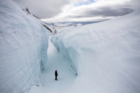
Glacial crevasse image via Shutterstock.


