
Millions of Americans live in flood-prone areas. In 2012 alone, the cost of direct flood damage hit nearly half a billion dollars. However, because the factors contributing to flood risk are not fully understood, river basin management — and even the calculation of flood insurance premiums — may be misguided. A new study by UC Santa Barbara’s Michael Singer and colleagues presents a paradigm shift in flood hazard analysis that could change the way such risk is assessed in the future. The results are published in the journal Geophysical Research Letters.
Millions of Americans live in flood-prone areas. In 2012 alone, the cost of direct flood damage hit nearly half a billion dollars. However, because the factors contributing to flood risk are not fully understood, river basin management — and even the calculation of flood insurance premiums — may be misguided.
A new study by UC Santa Barbara’s Michael Singer and colleagues presents a paradigm shift in flood hazard analysis that could change the way such risk is assessed in the future. The results are published in the journal Geophysical Research Letters.
Existing analyses attribute flood hazard to how often high water flows occur. They don’t, however, take into account the ability of river channels to accommodate them. The researchers present a novel method that compares the effects of channel capacity and stream flow on flood hazard frequency. They also document how flood hazard has changed over time in more than 400 streams across the United States.
“Our results demonstrate that changes in river channel boundaries directly impact flood hazard trends across the U.S.,” said Singer, an associate researcher at UCSB’s Earth Research Institute. “We show that in order to accurately calculate flood hazard and insurance premiums for river basins, channel capacity needs to be considered jointly with stream flow.”
Lead author Louise Slater, a Ph.D. student at the University of St. Andrews in Scotland, gathered recently digitized U.S. Geological Survey (USGS) data. Using sophisticated filtering processes, she whittled down the original dataset of 11,000 stations to 401 that were well distributed across the country and developed a procedure for separating the effects of hydrology and geomorphology on flood hazard. On average, the study data spanned about 40 to 60 years for each location.
In order to find relative magnitudes of two data components — water quantity as well as channel size and condition — the researchers separated these factors and then investigated how they might interact with each other. Water quantity is also known as the flow frequency effect; channel size and conditions (morphology) is referred to as the channel capacity.
“If there’s more water coming from the watershed but the channel gets enlarged somehow, that would offset the increased water flow,” Singer explained. “These two factors potentially interacting could have no change or they could increase the amount of change in one direction or another.”
Continue reading at UC Santa Barbara.
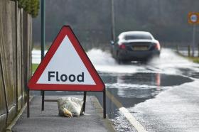
Flood image via Shutterstock.


