
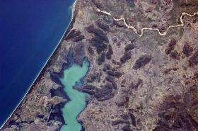
In November 2016, satellites captured a curious change in the Tereneyskoe Forest farm in Primorsky Krai, Russia. Images showed the area transformed, from nice and leafy to stark and stumpy. An Earth-monitoring company called Astro Digital noticed the change first—and right away, it informed the World Wildlife Federation. Pixels of evidence in hand, the federation could start legal action to stop the deforestation.
In November 2016, satellites captured a curious change in the Tereneyskoe Forest farm in Primorsky Krai, Russia. Images showed the area transformed, from nice and leafy to stark and stumpy. An Earth-monitoring company called Astro Digital noticed the change first—and right away, it informed the World Wildlife Federation. Pixels of evidence in hand, the federation could start legal action to stop the deforestation.
Before quick-cadence satellite imagery, often no one but the fellers were there to hear or see a tree fall in the forest. Now, when Astro Digital’s algorithms suspect something, the company pulls in months of data from the European Space Agency’s Sentinel-2 satellite, and human operators confirm the signs of logging.
These tools—the ability not just to see changes as they happen but also to rapidly interpret them—are increasingly attainable, even for cost-cutting nonprofits like the World Wildlife Federation. And the Earth observation industry needs that: not just pixels but what they portend. More satellites than ever set their sights on the world, taking millions of images and yielding even more megabytes. All of that data does no good unless someone can make sense of it, and fast.
Read more at Wired
Photo credit: NASA via Wikimedia Commons


