
Days after fatal debris flows devastated Southern California’s Montecito community, a team of U.S. Geological Survey geologists joined county, state, and federal partners to survey and evaluate the aftermath. Commonly known as mudslides or mudflows, debris flows are slurries of water, rock, soil, vegetation, and boulders with the consistency of wet concrete that can move rapidly downhill and down channel.
Days after fatal debris flows devastated Southern California’s Montecito community, a team of U.S. Geological Survey geologists joined county, state, and federal partners to survey and evaluate the aftermath. Commonly known as mudslides or mudflows, debris flows are slurries of water, rock, soil, vegetation, and boulders with the consistency of wet concrete that can move rapidly downhill and down channel.
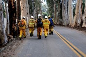
USGS geologists from the Landslide Hazards Program and Earthquake Science Center deployed to Santa Barbara County to support a geohazard assessment of the Montecito area; led by the California Geological Survey, with the support of the California Department of Forestry and Fire Protection (CAL FIRE).
“We’re mapping the area that’s been inundated by debris flows so that we are able to get some sense of the spatial extent of the area debris flows impacted, as well as the magnitude of the flows,” said USGS geologist Dennis Staley. “We will also be able to produce a forensic reconstruction of what happened throughout the event.”
Based on the information the group collects from the area, they can estimate the velocity and other dynamics of the flow to better understand and forecast how similar events might behave in the future.
Continue reading at USGS.
Image via USGS.


