
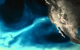
Those long, intense plumes of moisture in the sky known as atmospheric rivers are a vital water source to communities along the U.S. West Coast. In their absence, desiccating droughts can develop. But in their presence, they can cause extreme rain and floods that can disrupt travel, cause landslides, and trigger infrastructure failures.
Those long, intense plumes of moisture in the sky known as atmospheric rivers are a vital water source to communities along the U.S. West Coast. In their absence, desiccating droughts can develop. But in their presence, they can cause extreme rain and floods that can disrupt travel, cause landslides, and trigger infrastructure failures.
Currently, no guidance exists to help decision-makers plan for these events more than two weeks in advance, but a new study in the Nature Partner Journal Climate and Atmospheric Science describes a breakthrough in accurately predicting atmospheric river behavior several weeks ahead.
A team of Colorado State University (CSU) atmospheric scientists, funded by NOAA Research’s MAPP Program, developed and tested a model fed by careful analysis of 37 years of historical weather data. Their model centers on the relationship between two well-known global atmospheric patterns: the Madden-Julian Oscillation (MJO)—a recurring tropical rainfall pattern—and the Quasi-Biennial Oscillation (QBO)—an alternating pattern of winds high up in the stratosphere, above the MJO.
These phenomena occur thousands of miles from the U.S. along the Earth's equator. But the research team, led by former graduate researcher Bryan Mundhenk, knows that far-flung, interconnected processes between the ocean and atmosphere are crucial to making better, longer-term predictions than are currently possible.
Continue reading at NOAA.
Image via NOAA.


