
Tropical Cyclone Marcus continues to strengthen as it moves further away from Western Australia. NASA's Aqua satellite analyzed the system in infrared light to find the strongest part of the hurricane.
Tropical Cyclone Marcus continues to strengthen as it moves further away from Western Australia. NASA's Aqua satellite analyzed the system in infrared light to find the strongest part of the hurricane.
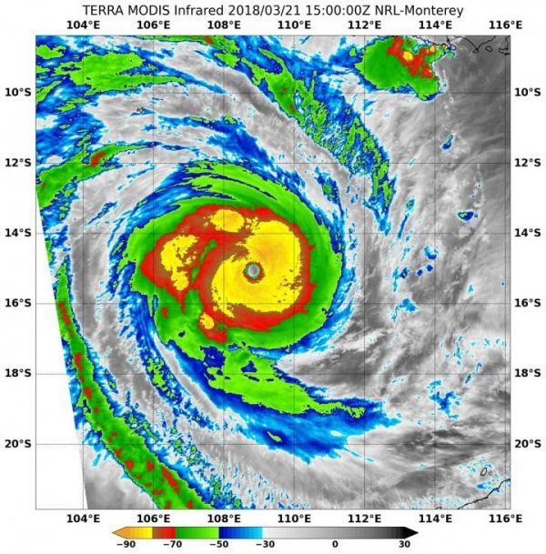
By analyzing a storm in Infrared light, scientists can tell cloud top temperatures that give clues about the location of the highest, coldest and strongest storms.
On March 20 at 2:35 a.m. EDT (0635 UTC) the Moderate Resolution Imaging Spectroradiometer or MODIS instrument aboard NASA's Aqua satellite analyzed Tropical Cyclone Marcus' cloud top temperatures in infrared light. MODIS found cloud top temperatures of strongest thunderstorms were as cold as or colder than minus 80 degrees Fahrenheit (minus 62.2 Celsius) north and east of the center of circulation. Cloud top temperatures that cold indicate strong storms that have the capability to create heavy rain.
Satellite imagery showed that the eye was 11 nautical miles wide, and that bands of thunderstorms were wrapped tightly into the low-level center.
Read more at NASA/Goddard Space Flight Center
Image: On March 21 at 11:00 a.m. EDT (1500 UTC) NASA's Terra satellite analyzed cloud top temperatures in thunderstorms (yellow) circling Tropical Cyclone Marcus' 20 nautical-mile-wide eye. Those temperatures were as cold as minus 80 degrees Fahrenheit (minus 62.2 Celsius). (Credit: NRL/NASA)


