
NASA's Terra satellite passed over the Arafura Sea and captured an image of newly developed Tropical Cyclone 16P.
NASA's Terra satellite passed over the Arafura Sea and captured an image of newly developed Tropical Cyclone 16P.
The Arafura Sea is part of the western Pacific Ocean, located between Australia's north coast and the south coast of New Guinea.
On March 22, the Australian Bureau of Meteorology or ABM, posted a warning and watch for 16P. The Warning Zone stretches from Elcho Island to Cape Shield, including Nhulunbuy. The Watch Zone runs from the Northern Territory/Queensland border to Thursday Island, including Weipa.
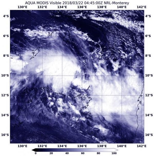
On March 23, the Moderate Resolution Imaging Spectroradiometer or MODIS instrument aboard NASA's Aqua satellite captured a visible light image of newly formed Tropical Cyclone 16P north of Nhulunbuy. Animated enhanced infrared satellite imagery showed a consolidating system with a developing band of thunderstorms wrapping in from the west which means the storm is getting better organized.
Read more at NASA/Goddard Space Flight Center
Image: On March 23, the MODIS instrument aboard NASA's Aqua satellite captured a visible light image of newly formed Tropical Cyclone 16P. (Credit: NASA Goddard MODIS Rapid Response Team)


