
Tropical Depression Jelawat, a newly-formed tropical cyclone over Western Micronesia is expected to strengthen into a Tropical Storm and enter the southeastern border of the Philippines by this afternoon (March 26). However, this storm is too far away to actually affect any part of the country.
Tropical Depression Jelawat, a newly-formed tropical cyclone over Western Micronesia is expected to strengthen into a Tropical Storm and enter the southeastern border of the Philippines by this afternoon (March 26). However, this storm is too far away to actually affect any part of the country. The developing center was located over the western part of Micronesia (near 6.6N 139.5E), about 560 km east of Koror, Republic of Palau or 1,465 km east of Mati City, Davao Oriental. Tropical Storm Jelawat is predicted to gradually veer northwest, and later north and northeast. The system will intensify to 55 knots before starting to weaken.
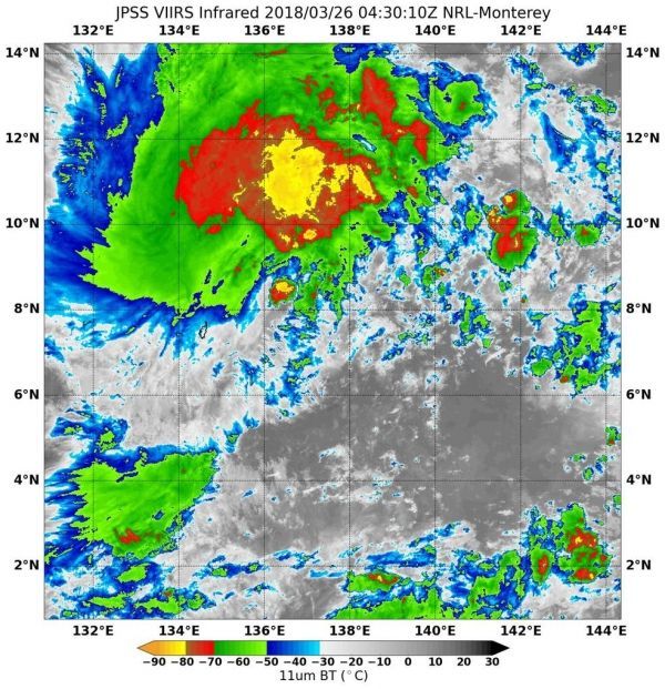
This image was taken by NOAA/NASA's Suomi NPP satellite on March 26, 2018. The Visible Infrared Imaging Radiometer Suite (VIIRS) of instruments captured an infrared image of the storm. The Suomi NPP satellite is a joint mission between NASA and NOAA.
Read more at NASA / Goddard Space Flight Center
Image: NOAA / NASA's Suomi NPP satellite captured this infrared image with its VIIRS suite of instruments on March 26, 2018. CREDITS: NOAA / NASA Goddard Rapid Response Team


