
NASA's Terra satellite passed over the Coral Sea and captured an image of Tropical Cyclone Iris as it continued weakening and moving away from the coast of Queensland, Australia.
The Australian Bureau of Meteorology dropped all warnings for land areas, but maintained a High Seas Weather Warning for Metarea 10.
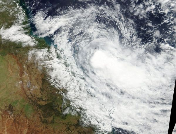
On April 5 the Moderate Resolution Imaging Spectroradiometer or MODIS instrument aboard NASA's Terra satellite captured a visible light image of Iris. The image showed a concentration of strong thunderstorms around the center of circulation. MODIS infrared data showed that some of those storms had cloud top temperatures as cold as minus 80 degrees Fahrenheit (minus 62.2 degrees Celsius), indicating they are high in the troposphere. NASA research has shown that storms with cloud tops that high and cold have the ability to generate heavy rainfall.
The MODIS image also showed that wind shear was affecting the storm, and it appeared somewhat elongated as a large area of clouds were being pushed to the southeast of the center.
Read more at NASA / Goddard Space Flight Center
Image: On April 5, the MODIS instrument aboard NASA's Terra satellite captured a visible light image of Tropical Cyclone Iris, weakening off the coast of eastern Queensland, Australia. CREDITS: NASA Goddard MODIS Rapid Response Team


