
Strong vertical wind shear had taken its toll on Tropical Cyclone Flamboyan when NASA's Aqua satellite passed over the Southern Indian Ocean. Flamboyan, now a subtropical cyclone, had been stretched out and its only precipitation pushed southeast of the center.
The Moderate Resolution Imaging Spectroradiometer or MODIS instrument aboard NASA's Aqua satellite provided a visible image of Flamboyan on May 2 at 3:50 a.m. EDT (0750 UTC). The storm was devoid of rainfall with the exception of the southeastern quadrant. Wind shear has pushed all the storm southeast of the center.
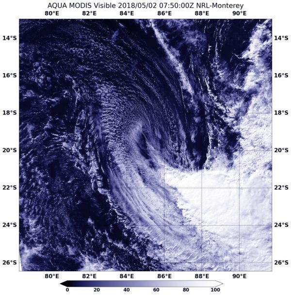
At 11 p.m. EDT on May 1, or 0300 UTC on May 2, the Joint Typhoon Warning Center (JTWC) issued their final warning on the system. At that time the center of Tropical Cyclone Flamboyan was located near 19.1 degrees south and 84.6 degrees east, about 983 nautical miles southeast of Diego Garcia. The storm was moving toward the south-southeast at 5.7 mph (5 knots/9.2 kph). Maximum sustained winds are near 46 mph (40 knots/74 kph).
Read more at NASA / Goddard Space Flight Center
Image: NASA's Aqua satellite provided a visible image of Tropical Cyclone Flamboyan on May 2 at 3:50 a.m. EDT (0750 UTC). The storm is devoid of rainfall with the exception of the southeastern quadrant. Wind shear has pushed all the storm southeast of the center. CREDITS: NASA/NRL


