
Onward! Our next order of business is to bid adieu to La Niña, as the sea surface temperature in the tropical Pacific returned to neutral conditions in April—that is, within 0.5°C of the long-term average.
First off, happy blogiversary to our readers and the ENSO blog team! Hard to believe my first post was four years ago this month. Who would have thought we would still have so much to say about ENSO and the world of climate forecasting? If you’re new to us, or want to revisit old favorites, be sure to check out the index page our amazing editor put together.
Onward! Our next order of business is to bid adieu to La Niña, as the sea surface temperature in the tropical Pacific returned to neutral conditions in April—that is, within 0.5°C of the long-term average.
The temperature of the water below the surface remained above-average, as the large area of warmer-than-average subsurface waters continued to move slowly to the east (a downwelling Kelvin wave). This warm area will continue to erode the remaining cooler surface waters over the next few months.
The tropical atmosphere is also looking mostly neutral. Rainfall over Indonesia was below average, and the near-surface winds were close to average, as La Niña’s strengthened Walker circulation faded.
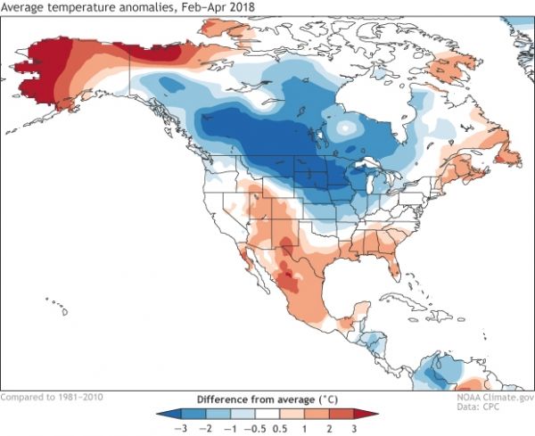
Let’s look back on the past few months, to see how much February–April global temperature and rain patterns reflected those expected (temperature, rain) during La Niña! The maps linked here show both the changes expected during ENSO and the observed temperature trends, and the combination of the two.
Continue reading at NOAA.
Image via NOAA.


