
NASA-NOAA’s Suomi NPP satellite saw the Eastern Pacific Ocean’s first tropical storm coming together.
NASA-NOAA’s Suomi NPP satellite saw the Eastern Pacific Ocean’s first tropical storm coming together.
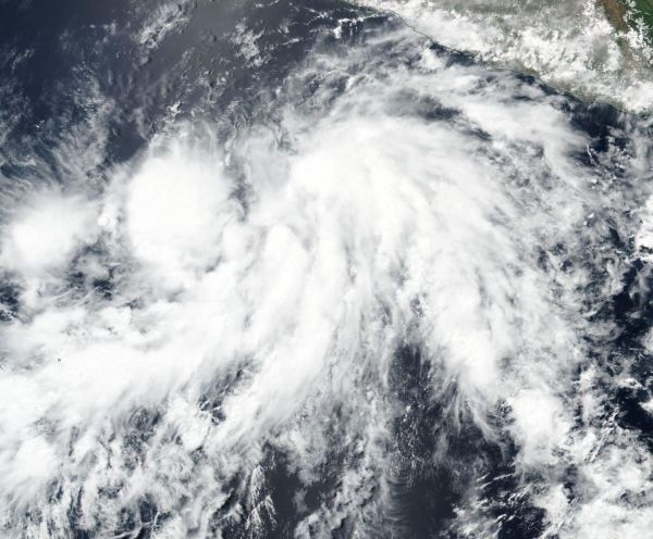
On June 5, the Visible Infrared Imaging Radiometer Suite (VIIRS) instrument aboard NASA-NOAA's Suomi NPP satellite captured a visible image of Tropical Storm Aletta as it was developing. The VIIRS image showed a better, more organized circulation center with consolidating banding of thunderstorms wrapping into a well-defined low level circulation center. The image was created at NASA's Goddard Space Flight Center in Greenbelt, Md.
By 11 a.m. EDT on June 5, the low pressure area had organized into a tropical depression. Six hours later at 5 a.m. EDT on June 6, tropical depression 1E strengthened into Tropical Storm Aletta, the first of the Eastern Pacific Ocean hurricane season.
Read more at NASA/Goddard Space Flight Center
Image: On June 5, NASA-NOAA's Suomi NPP satellite captured a visible image of Tropical Storm Aletta as it was developing in the Eastern Pacific Ocean. (Credit: NOAA/NASA Goddard Rapid Response Team)


