
When NASA's Aqua satellite passed over the South China Sea on June 7 infrared imagery showed Tropical Storm Ewiniar's center made landfall in southeastern China.
When NASA's Aqua satellite passed over the South China Sea on June 7 infrared imagery showed Tropical Storm Ewiniar's center made landfall in southeastern China.
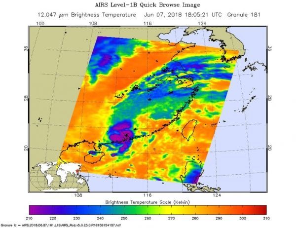
NASA's Aqua satellite passed over Tropical Storm Ewiniar on June 7 at 2:05 p.m. EDT (1805 UTC). The Atmospheric Infrared Sounder or AIRS instrument analyzed the storm in infrared light which provides temperature information. Temperature is important when trying to understand how strong storms can be. The higher the cloud tops, the colder and the stronger they are.
AIRS saw coldest cloud top temperatures in a small area around the center of circulation. Those cloud top temperatures were as cold as minus 63 degrees Fahrenheit (minus 53 degrees Celsius). Storms with cloud top temperatures that cold have the capability to produce heavy rainfall. Bands of thunderstorms extended far to the northeast of the center, but cloud tops in them were a lot warmer, meaning the storms were weaker.
Read more at NASA / Goddard Space Flight Center
Image: NASA's Aqua satellite passed over Tropical Depression Ewiniar on June 7 at 2:05 p.m. EDT (1805 UTC) and saw coldest cloud top temperatures (purple) around the center of circulation in a small area on the southeastern China coast. CREDITS: NASA JPL / Ed Olsen


