
Well, well, well… what have we here? Favorable conditions for El Niño to develop?
Well, well, well… what have we here? Favorable conditions for El Niño to develop? The June ENSO forecast estimates a 50% chance of El Niño developing during the late summer or early autumn, and an approximately 65% chance of El Niño conditions in the winter, so forecasters have instituted an El Niño Watch.
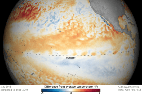
Before we get into the potential for El Niño, let’s talk about right now. We are in neutral, and forecasters expect that ENSO-neutral conditions will play on through the summer. The surface temperature of the tropical Pacific Ocean is close to the long-term average in most areas, including the Niño3.4 region (our primary monitoring region for ENSO), which was smack-dab on the average in the latest weekly measurement.
Another interesting thing this map shows us is the prominent pattern of warmer-than-average surface temperatures north of the equator, and cooler-than-average waters south of the equator. This illustrates the strongly positive phase of the Pacific Meridional Mode… which I’ll get to in a minute.
The atmosphere is also looking pretty ENSO-neutral. Remember, warmer-than-average waters tend to evaporate more water and warm the air above them, creating more rising motion and clouds than average. Cooler waters are the reverse, resulting in less cloud cover than average. During a La Niña event such as this past winter, we expect fewer clouds over the central Pacific, and more over Indonesia, which demonstrates the atmospheric response to La Niña’s cooler-than-average central Pacific.
Continue reading at NOAA.
Image via NOAA.


