
Tropical Storm Daniel was weakening when NASA’s Terra satellite passed overhead on June 24 and by June 26 the storm degenerated into a remnant low pressure area.
Tropical Storm Daniel was weakening when NASA’s Terra satellite passed overhead on June 24 and by June 26 the storm degenerated into a remnant low pressure area.
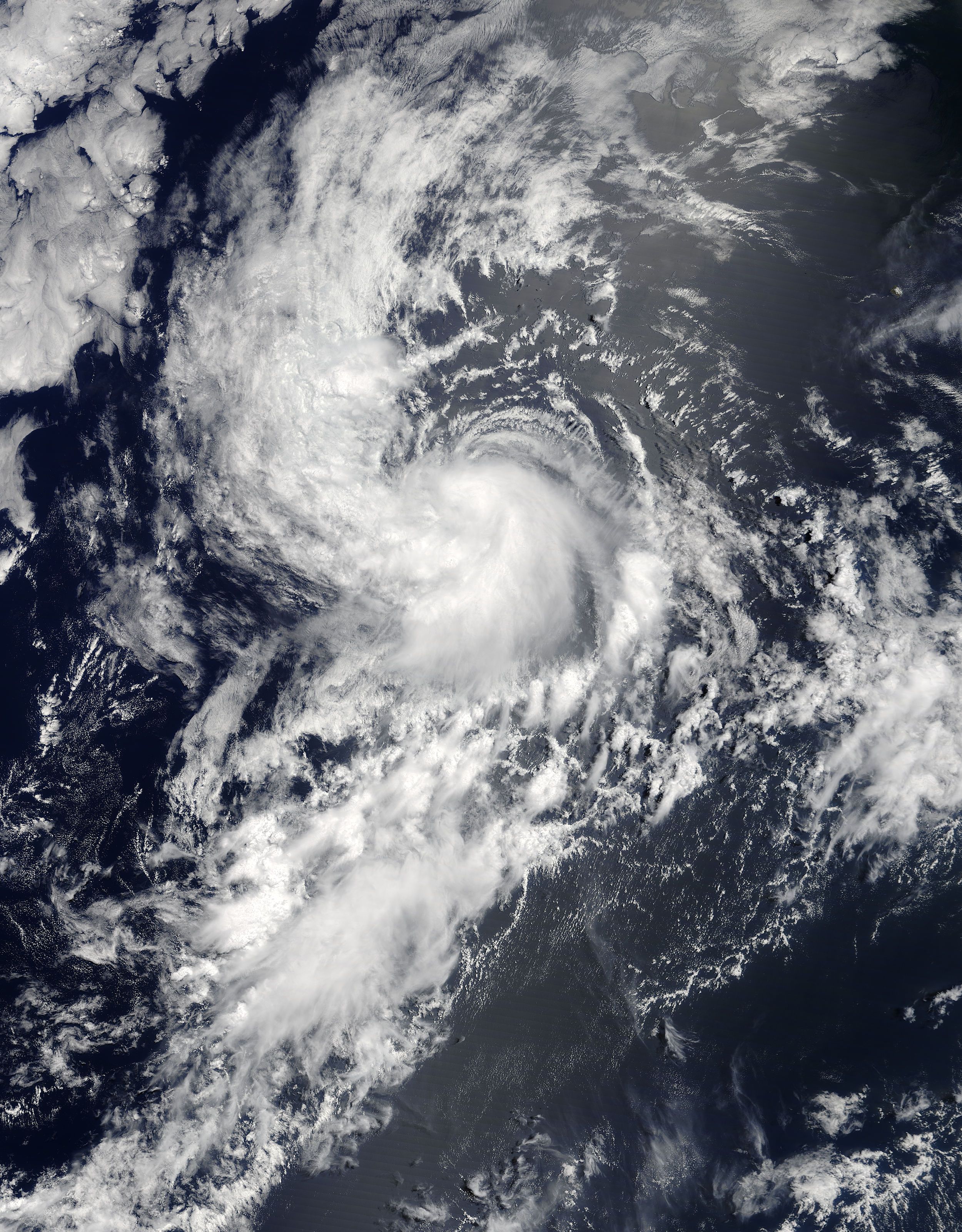
On June 24, the Moderate Resolution Imaging Spectroradiometer or MODIS instrument aboard NASA’s Terra satellite captured a visible image of Tropical Storm Daniel at 2:30 p.m. EDT (1830 UTC), when it was off the west coast of Mexico. The image showed a small, concentrated area of strong storms around the center of circulation with bands of thunderstorms feeding into the center.
Two and a half hours later, the National Hurricane Center noted “Daniel continues to generate a curved band of convection near the center, although the cloud tops have warmed notably during the past several hours.”
Read more at NASA / Goddard Space Flight Center
Image: On June 24, NASA’s Terra satellite captured a visible image of Tropical Storm Daniel at 2:30 p.m. EDT (1830 UTC), when it was off the west coast of Mexico. CREDITS: NASA Goddard Rapid Response Team


