
The Northwestern Pacific Ocean has been churning out tropical cyclones over the past couple of weeks and the tenth tropical depression formed as NASA's Aqua satellite passed overhead in space. Tropical Storm Warnings are in effect for Guam as 10W approaches the island.
The Northwestern Pacific Ocean has been churning out tropical cyclones over the past couple of weeks and the tenth tropical depression formed as NASA's Aqua satellite passed overhead in space. Tropical Storm Warnings are in effect for Guam as 10W approaches the island.
On July 3 at 11 p.m. local time, the National Weather Service (NWS) in Tiyan, Guam noted a tropical storm warning remains in effect for Guam. Tropical storm conditions, including damaging winds of 39 mph or more, are expected within 24 hours. A tropical storm watch remains in effect for Rota, Tinian and Saipan. Tropical storm conditions, including damaging winds of 39 mph or more, are possible within 24 to 36 hours.
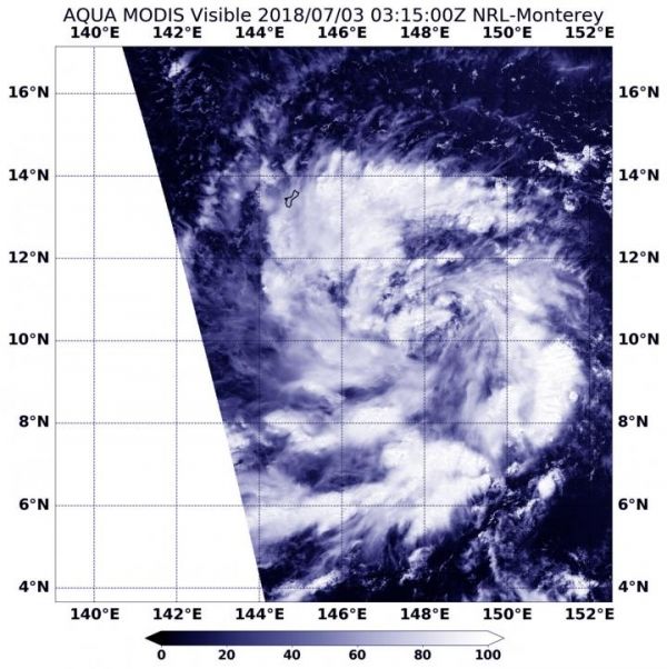
The MODIS instrument or Moderate Resolution Imaging Spectroradiometer aboard NASA's Aqua satellite took a visible picture of Tropical Depression 10W on July 3 at 0315 UTC (July 2 at 11:15 p.m. EDT). The image showed fragmented bands of thunderstorms surrounding a low-level center. The storm was not yet organized.
Read more at NASA/Goddard Space Flight Center
Image: NASA's Aqua satellite took a visible picture of Tropical Depression 10W on July 3 at 0315 UTC (July 2 at 11:15 p.m. EDT). The image showed fragmented bands of thunderstorms surrounding a low-level center. The storm was not yet organized. The island of Guam is seen in the top left corner of the image, northwest of the storm. (Credit: NASA/NRL)


