
In collaboration with a nature reserve in Namibia, researchers funded by the SNSF are developing a new approach to counting animals: combining drone flights and automated image analysis.
In collaboration with a nature reserve in Namibia, researchers funded by the SNSF are developing a new approach to counting animals: combining drone flights and automated image analysis.
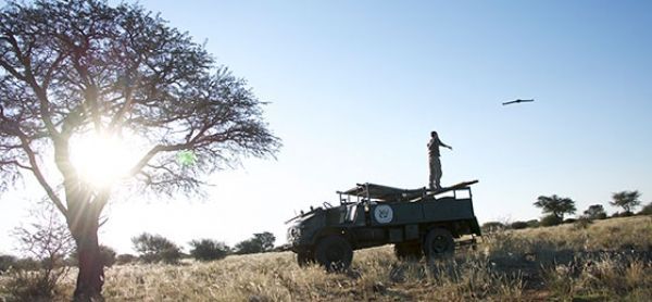
A new technique developed by Swiss researchers enables fast and accurate counting of gnu, oryx and other large mammals living in wildlife reserves. Drones are used to remotely photograph wilderness areas, and the images are then analysed using object recognition software and verified by humans. The work is reported in a paper published in the journal Remote Sensing of Environment. (*)
The challenge is daunting: some African national parks extend over areas that are half the size of Switzerland, says Devis Tuia, an SNSF Professor now at the University of Wageningen (Netherlands) and a member of the team behind the Savmap project, launched in 2014 at EPFL. “Automating part of the animal counting makes it easier to collect more accurate and up-to-date information.”
No animal left uncounted
The drones make it possible to cover vast areas economically. But it’s more complicated than simply sending them up to photograph the terrain: more than 150 images are taken per square kilometre. At first glance, it’s hard to tell the animals from other features of the landscape such as shrubs and rocks.
Read more at Swiss National Science Foundation (SNSF)
Photo Credit: Swiss National Science Foundation (SNSF)


