
On Sunday, July 15, the National Hurricane Center (NHC) noted that Sub-Tropical Storm Beryl was devoid of precipitation around its center of circulation and infrared imagery from NASA's Aqua satellite confirmed it. By July 16, Beryl had again become a remnant low pressure area.
On Sunday, July 15, the National Hurricane Center (NHC) noted that Sub-Tropical Storm Beryl was devoid of precipitation around its center of circulation and infrared imagery from NASA's Aqua satellite confirmed it. By July 16, Beryl had again become a remnant low pressure area.
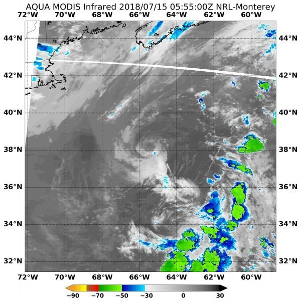
When NASA's Aqua satellite passed over Beryl on July 15 at 1:55 a.m. EDT (0555 UTC), it looked at the storm in infrared light. Infrared imagery shows cloud top temperatures. Clouds around Beryl's center had warmed from the previous day, indicating that the uplift of air to help create the thunderstorms (that make up the tropical cyclone) had weakened. The storms surrounding the center also appeared devoid of any precipitation. The cyclone was comprised of a swirl of low- to mid-level clouds with minimal convection in the southeastern quadrant.
NHC forecaster Jack Beven said "While the low-level center remains over the Gulf Stream, GOES-16 satellite air mass imagery indicates that the center is now west of the associated upper-level trough and that significant northerly vertical shear is occurring."
Read more at NASA / Goddard Space Flight Center
Image: When NASA's Aqua satellite passed over Beryl on July 15 at 1:55 a.m. EDT (0555 UTC), it looked at the storm in infrared light. The storms surrounding the center were devoid of any precipitation. The cyclone was comprised of a swirl of low- to mid-level clouds with minimal convection in the southeastern quadrant. CREDITS: NASA / NRL


