
NASA-NOAA's Suomi NPP satellite passed over the Northwestern Pacific Ocean and captured a visible image of recently formed Tropical Depression 11W.
NASA-NOAA's Suomi NPP satellite passed over the Northwestern Pacific Ocean and captured a visible image of recently formed Tropical Depression 11W.
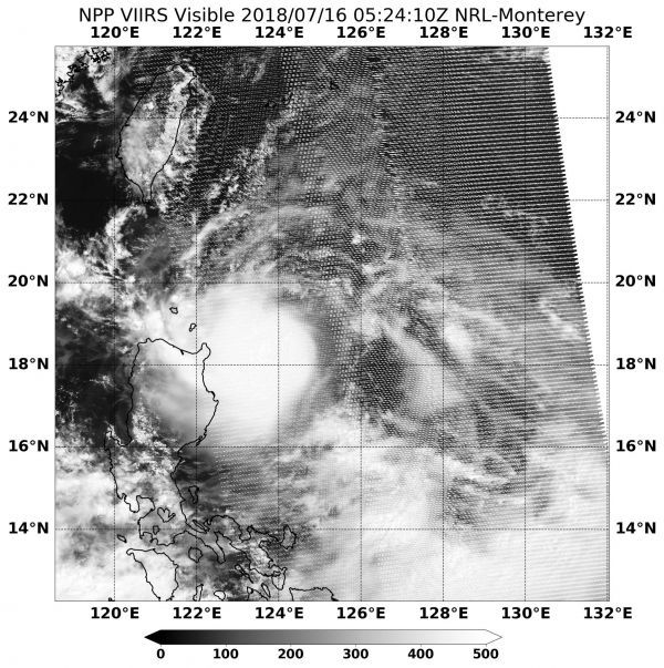
Tropical Cyclone 11W formed on July 15 and maintained strength as it moved west and approached the Philippines.
On June 16 at 11 a.m. EDT (1500 UTC) the Visible Infrared Imaging Radiometer Suite (VIIRS) instrument aboard NASA-NOAA's Suomi NPP satellite captured visible image of 11W.
The VIIRS image showed 11W's center was located between just off the northeastern coast of Luzon, northern Philippines. VIIRS showed a powerful band of thunderstorms wrapping into the low-level center. The southwestern quadrant of 11W was over Luzon, bringing gusty winds, rough seas and heavy rainfall.
Read more at NASA / Goddard Space Flight Center
Image: On July 16 at 1:24 a.m. EDT (0524 UTC) the VIIRS instrument aboard NASA-NOAA's Suomi NPP satellite captured a visible image of Tropical Cyclone 11W located near the northeastern coast of Luzon, Philippines. CREDITS: NOAA / NASA Goddard Rapid Response Team


