
NASA-NOAA’s Suomi NPP satellite flew over Tropical Storm Son-Tinh on July 18 after it crossed over Hainan Island, China and as it moved into the Gulf of Tonkin.
NASA-NOAA’s Suomi NPP satellite flew over Tropical Storm Son-Tinh on July 18 after it crossed over Hainan Island, China and as it moved into the Gulf of Tonkin.
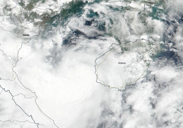
The Visible Infrared Imaging Radiometer Suite (VIIRS) instrument aboard NASA-NOAA's Suomi NPP satellite captured a visible image that showed a compact system with a small area of deep and persistent convection.
At 5 a.m. EDT (0900 UTC) the Joint Typhoon Warning Center (JTWC) reported the center of Tropical Storm Son-Tinh was located near latitude 19.0 degrees north and longitude 107.4 degrees east. That's about 173 nautical miles southeast of Hanoi, Vietnam. Son-Tinh was moving to the west. Maximum sustained winds were near 46 mph (40 knots/74 kph).
Read more at NASA / Goddard Space Flight Center
Image: On July 19, NASA-NOAA's Suomi NPP satellite captured a visible image of Tropical Storm Son-Tinh in the Gulf of Tonkin. The image showed a compact system with a small area of deep and persistent convection. CREDITS: NASA / NOAA / NRL


